
What is Pha Din Pass Like?
Pha Din Pass is a high mountain route straddling the border of Son La and Dien Bien provinces in northwestern Vietnam, around 350 km from Hanoi. The name “Pha Din” comes from the Thai language and means “Heaven and Earth,” a reflection of both the altitude—peaking at 1,648 m—and the dramatic scenery. It’s considered one of Vietnam’s four legendary passes and played a key role in wartime logistics during the Dien Bien Phu campaign.

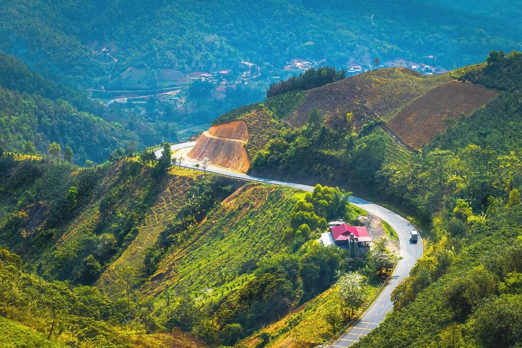
The full length of the pass is about 32 km, but most travelers only experience around 10 km of notable ascent or descent, depending on the direction. Coming from Son La, the climb is gradual and relatively gentle. From the Dien Bien side, the descent is noticeably steeper, with sharper corners and longer slopes. The road weaves along deep valleys and high cliffs, often shrouded in mist, especially in the colder months.
History & Local Legends
During the First Indochina War, Pha Din Pass held strategic importance as part of the main supply route for Vietnamese forces heading toward the battlefield at Dien Bien Phu. The French launched relentless airstrikes here in 1954 in an effort to block the flow of weapons, food, and reinforcements. Despite the danger, convoys and youth volunteers braved the steep, narrow road—many losing their lives in the process. Today, a memorial plaque at the summit honors those sacrifices and reminds visitors of the pass’s role in one of Vietnam’s most historic victories.
Beyond its wartime legacy, the pass is also wrapped in local legend. In the past, when the border between Lai Chau (now Dien Bien) and Son La was still disputed, a horse race was held from both sides to determine where the boundary should be drawn. The horses met at the peak, and the longer portion of the pass fell to Lai Chau. The story reflects the cultural pride both provinces feel for this dramatic mountain route.
Two routes: The Old Pass vs. The New Pass
If you look at the map, you’ll see two versions of the pass. The original road—marked as QL6 (cũ) or “Old National Highway 6”—is the historic route used during the French era. This older section is narrower, more winding, and steeper in places, offering more dramatic views but also requiring more care when driving. It was along this route that Vietnamese forces hauled artillery and supplies through jungle-covered slopes in 1954—and where captured French troops were later marched back toward Hanoi.
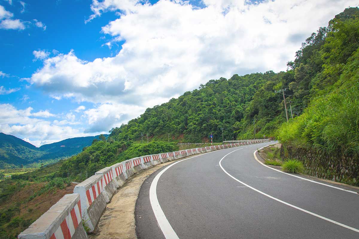
Today, most through-traffic takes the new bypass, a modern, wider road built to improve safety and connectivity. It runs parallel to the old pass but sits lower on the mountainside and avoids many of the sharpest turns. It’s the safer and quicker choice for cars, buses, and less confident drivers.
Things to See & Do along Pha Din Pass
1. Thrilling mountain drive
Pha Din is a memorable drive with sharp hairpin bends and gradients said to reach up to 19%—though real-world experience suggests it’s steep but manageable. Motorbike riders will enjoy the challenge and scenery, but should stay alert for tight corners, occasional landslides in the rainy season, and unpredictable drivers. The road down into Dien Bien is steeper than the climb from Son La, so be cautious with braking.
2. Panoramic viewpoints
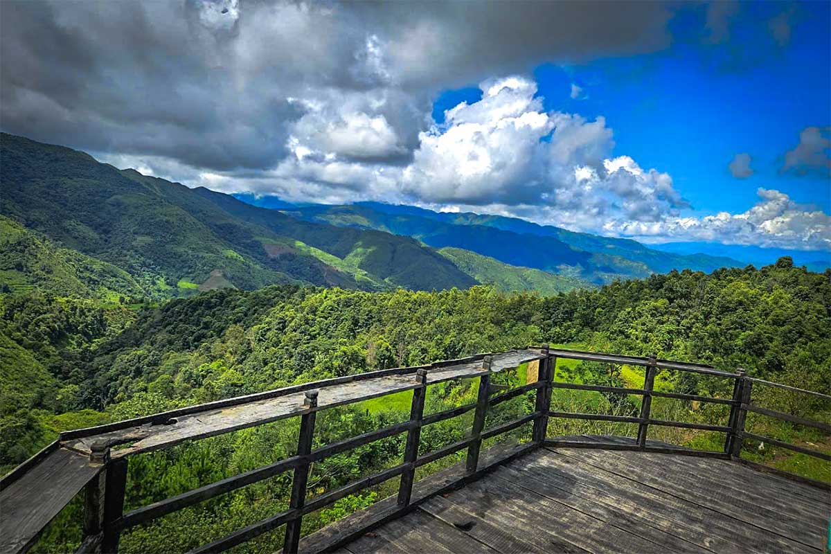
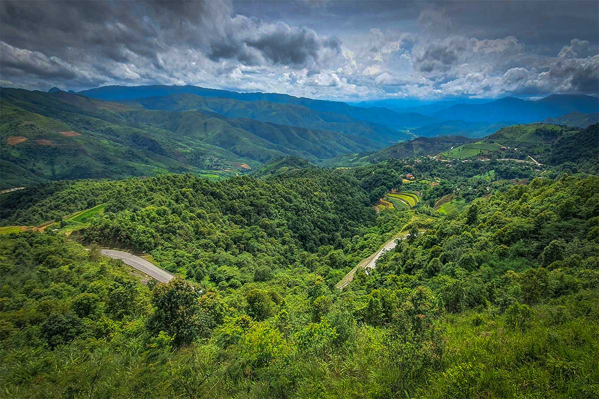
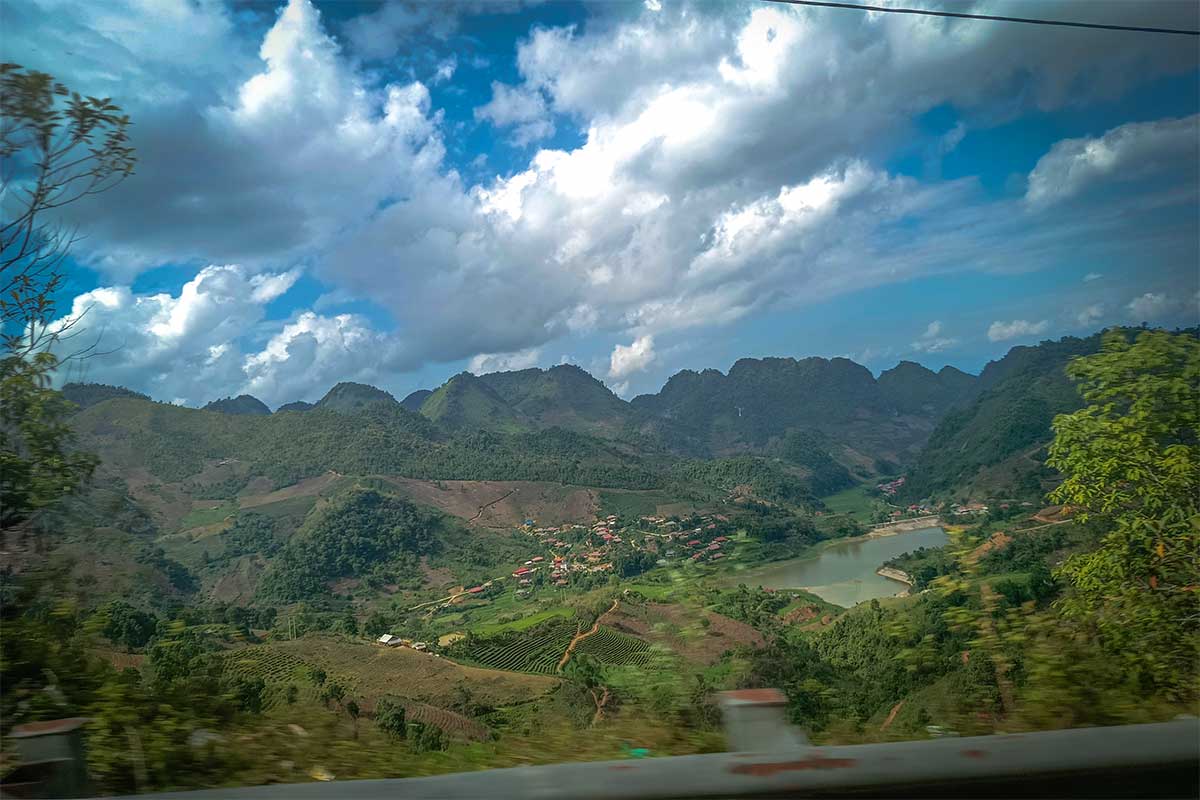
Throughout the pass, especially near the summit, you’ll find stunning views of the Muong Quai valley and surrounding hills. From October to March, early mornings can bring an impressive sea of clouds. There aren’t always official viewing platforms, but several rest spots and roadside areas let you pull over and take in the landscape.
3. Pha Din tourist area & flower gardens
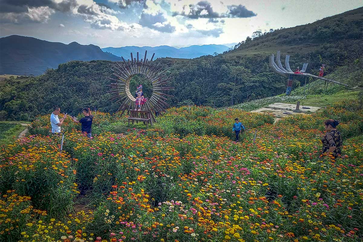
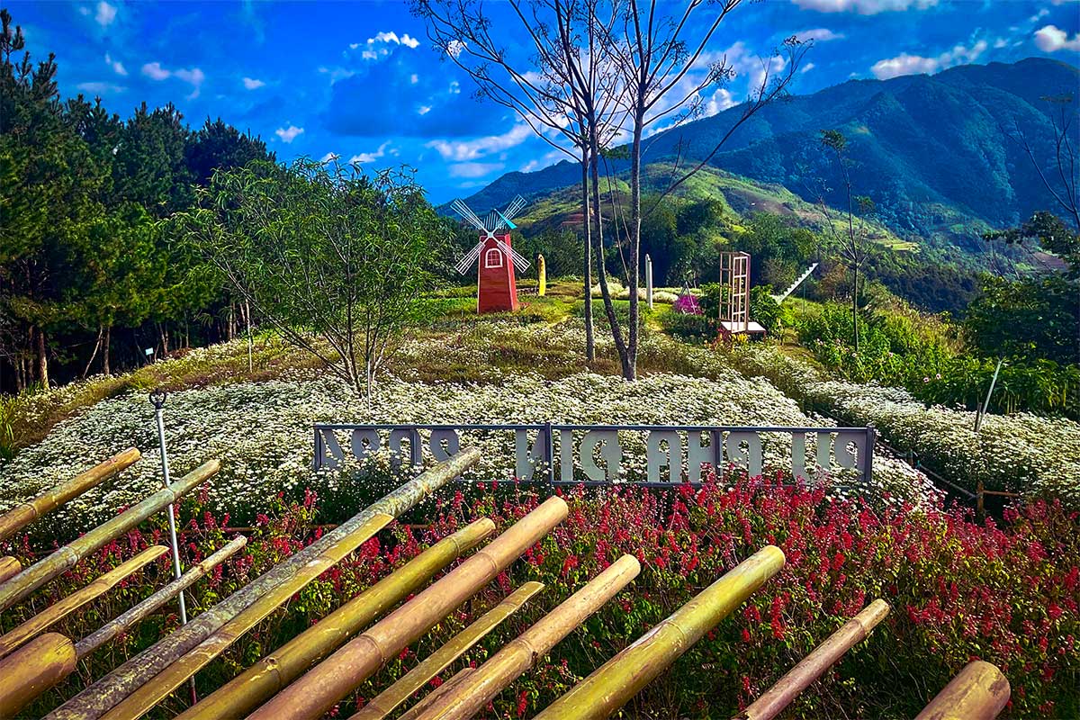
At the top of the pass, you’ll find a small tourist area created for rest and photos. While some parts feel overly staged with photo props aimed at domestic “check-in” culture, there are genuine reasons to stop: peaceful flower gardens (buckwheat, mustard, wildflowers), small cafés with views, and a cool highland atmosphere. Entry fees are minor, and even if you skip the selfie zones, the setting is pleasant for a short break.
4. Ethnic village views
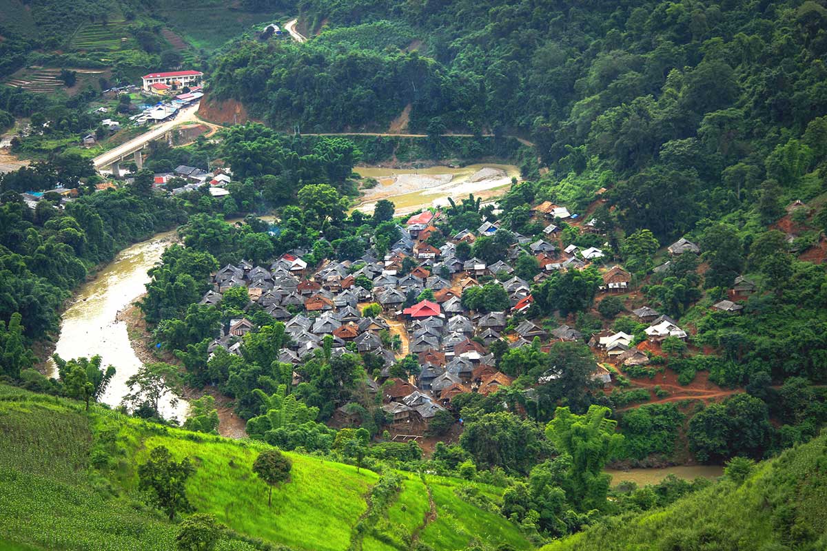
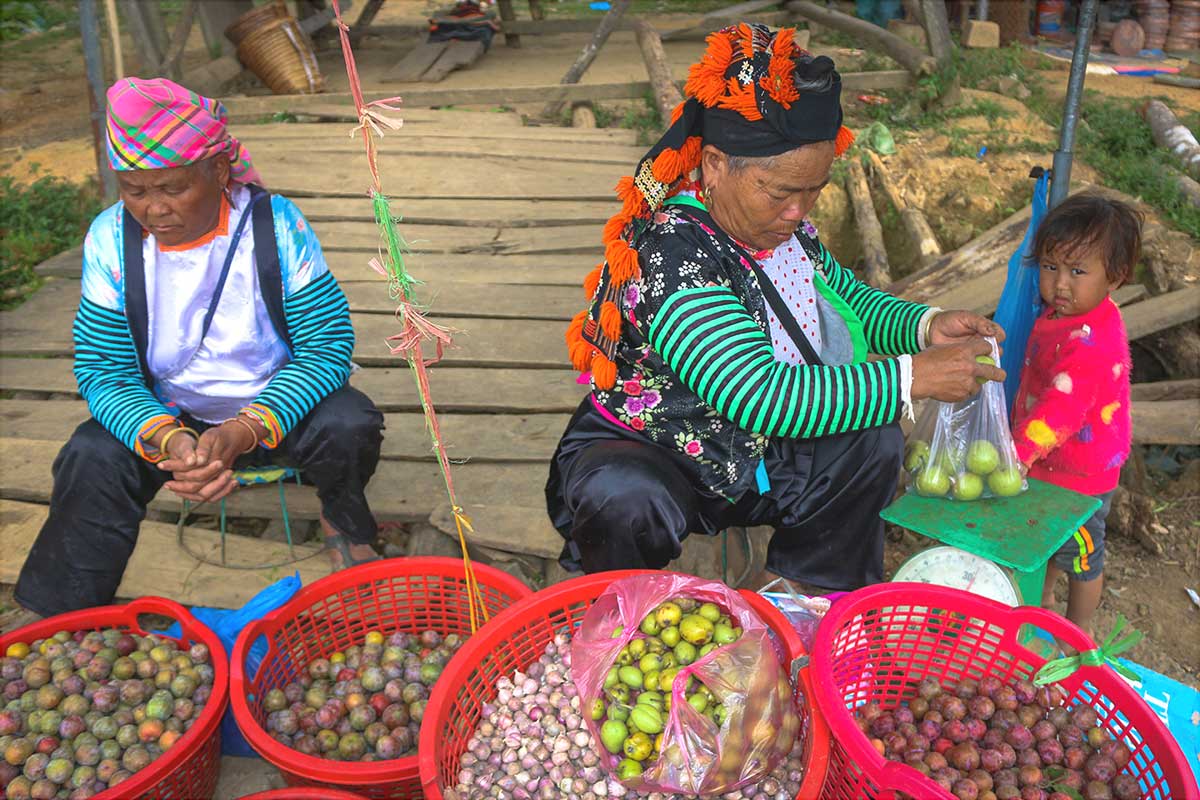
As you ascend or descend, you’ll pass through valleys dotted with Thai and Mong ethnic villages. While most are not tourist sites, their traditional stilt houses and terraced fields—growing coffee, cinnamon, or cardamom—are part of the scenery that gives the route its cultural richness.
5. Historical markers
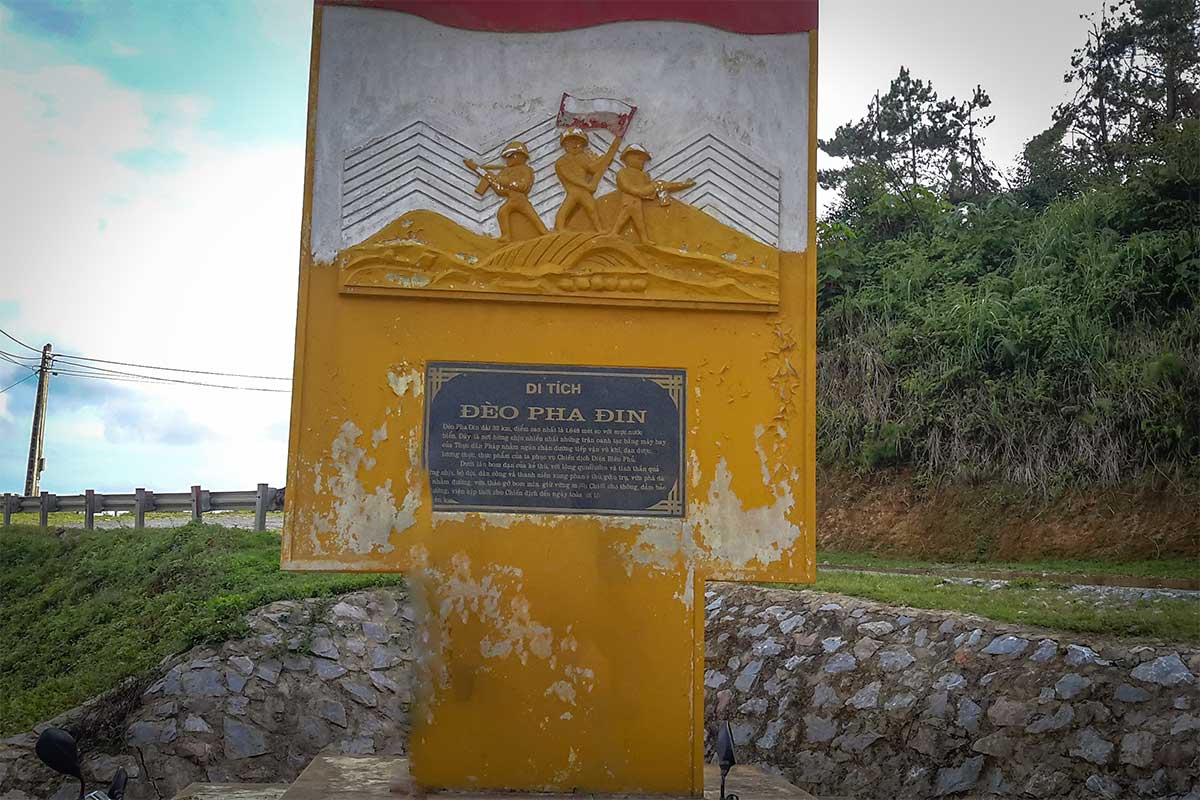
At the summit, a modest plaque marks the pass’s historical role in the 1954 campaign. The old road, now bypassed by the newer highway, still traces the route once used for military convoys and forced marches. Driving this older section feels more like a journey through history than a standard mountain crossing.
Practical tips & Logistics
Direction of travel & vehicle choice
Travelers cross Pha Din Pass either heading west toward Dien Bien or east toward Son La, depending on their route. Coming from Son La, the climb is long and gradual; from Dien Bien, the descent is steeper and requires careful braking. Motorbikes offer the most scenic and flexible experience, while cars are better for comfort and safety—especially in wet or foggy conditions.
Safety tips
Expect sharp blind turns, uneven road surfaces, and occasional oncoming traffic cutting corners. Always slow down before hairpins, stay in your lane, and watch for sudden drop-offs. If driving downhill, shift into a low gear to avoid overheating your brakes.
Weather & seasons
Fog is common in the early morning—especially from October to March—so drive with lights on and caution. The summit is often chilly year-round. Spring (Feb–Apr) brings beautiful plum and peach blossoms. Avoid the pass during or after heavy rain, as surfaces can become slippery and visibility drops fast.
Stops & facilities
There are only a few small rest stops, souvenir stalls, and coffee kiosks near the summit. Don’t expect fuel stations or full restaurants along the pass. Bring water, snacks, and warm clothing if you’re stopping at viewpoints.
Time required
Give yourself at least 1.5–2 hours to cross the old pass, longer if you want to stop for photos or coffee. The new road is faster but less scenic. Consider combining the pass with other nearby highlights in Dien Bien for a full day of travel.
Nearby attractions & Route suggestions
Pha Din Pass fits naturally into a west-to-east journey through northern Vietnam. One recommended route is from Son La to Dien Bien, where you climb the pass gradually, enjoy panoramic views from the top, and descend into the scenic Muong Thanh Valley. Along the way, you can explore:
- Ethnic minority villages nestled in the valleys
- Pa Khoang Lake – peaceful lake stop with boat rentals and viewpoints
- Pha Thoong Cave – a less-visited but impressive cave site near Dien Bien
- The full Dien Bien Phu battlefield area, including A1 Hill and the Victory Museum
If you’re coming from Lai Chau or Sapa, you’ll reach Dien Bien Phu by a different mountain road and skip Pha Din Pass entirely. But you can still drive the pass on your way back toward Son La or Hanoi—making it a scenic detour or part of a wider loop through the northwest.
For a full list of must-see places in the region, check our Dien Bien Phu highlights guide.