What is Dong Van Karst Plateau Geopark?
What is a UNESCO Global Geopark?
A UNESCO Global Geopark is an area with outstanding geological heritage, where natural landscapes are closely linked to local culture and community life. These parks focus on conservation, education, and sustainable tourism.
Vietnam has three UNESCO Global Geoparks:
- Dong Van Karst Plateau Geopark (Ha Giang)
- Non Nuoc Cao Bang Geopark (Cao Bang)
- Dak Nong Geopark (Central Highlands)
Each geopark highlights a unique part of Vietnam’s natural history and ethnic diversity.
Ha Giang’s Geopark
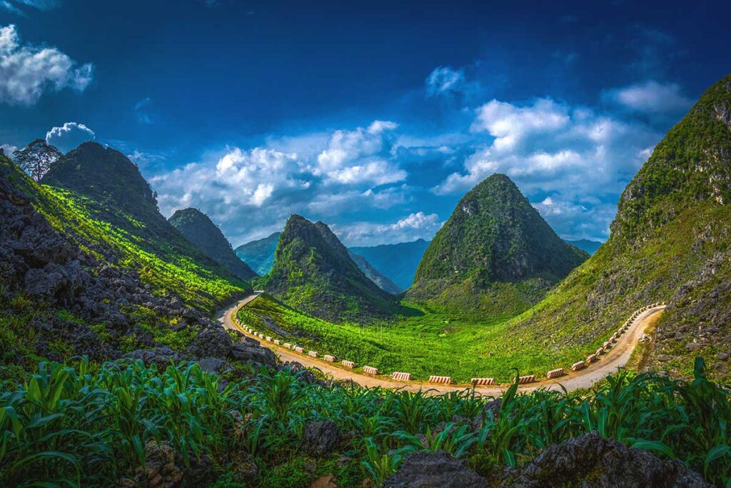
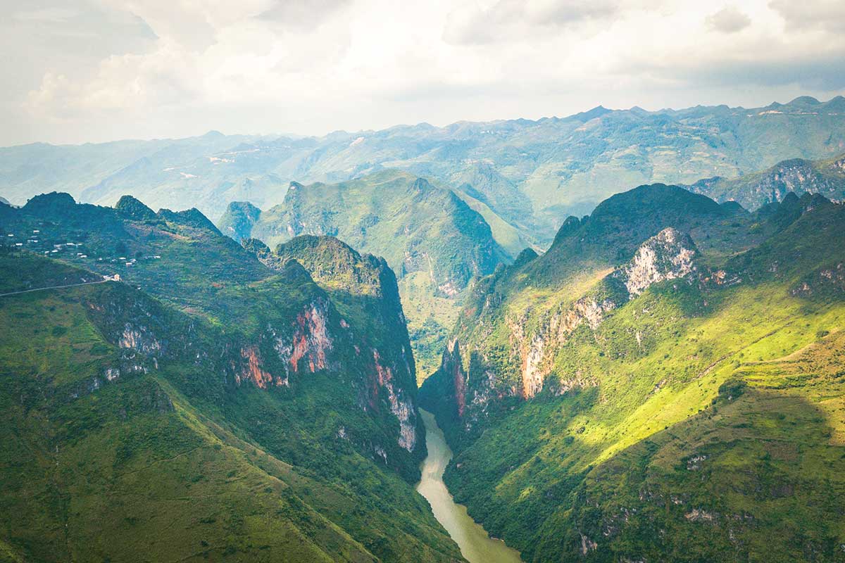
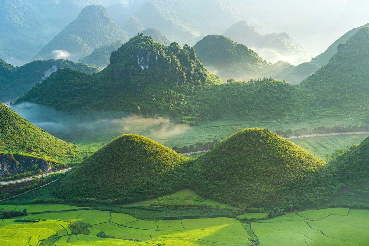
The Dong Van Geopark is dominated by sharp limestone peaks, deep valleys, and towering cliffs that formed over 500 million years. You’ll see exposed rock layers, fossil beds, caves, and ancient seabed formations that tell the story of Earth’s evolution.
But it’s not just about geology. The region is also home to more than 17 ethnic groups, including the Hmong, Tay, Dao, Lolo, and Giay. Each community maintains distinct traditions, from stilt houses and handmade clothing to colorful markets and farming practices shaped by the rugged terrain.
The geopark makes up the heart of the Ha Giang Loop, a popular motorbike or road trip route that winds through mountain passes like Ma Pi Leng and stops in villages, historic sites, and market towns along the way.
Where is Dong Van Karst Plateau Geopark?
Dong Van Karst Plateau Geopark is located in Ha Giang Province, in the far north of Vietnam, right along the border with China. It sits in one of the most remote and mountainous regions of the country, where winding roads cut through steep limestone peaks and deep valleys.
Despite the name, the geopark isn’t limited to Dong Van District. That district (and its capital town, also called Dong Van) is just one part of the geopark. The full geopark covers a much larger area, including the four main districts of the Ha Giang Loop: Dong Van, Meo Vac, Yen Minh, and Quan Ba. It also extends into Bac Me District, though this area is less visited. Most travelers pass through the heart of the geopark while doing the Loop, whether by motorbike, car, or private tour.
Best things to see in the Geopark
Dong Van Karst Plateau Geopark stretches across several districts in northern Ha Giang, covering much of the same area as the popular Ha Giang Loop. That means most of the top highlights along the Loop — from epic mountain passes to cultural villages — are also the key sights of the geopark. This region stands out not only for its dramatic landscapes but also for the rich ethnic cultures that have adapted to life in this rugged environment.
Here are the best things to see and experience in the Dong Van Karst Plateau Geopark:
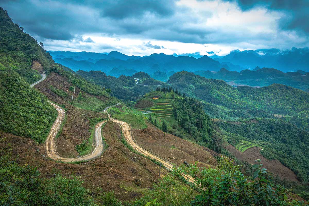
1. Ma Pi Leng Pass
Ma Pi Leng is often called the most impressive mountain pass in Vietnam — and it’s easy to see why. Carved into the edge of towering limestone cliffs, the road snakes along a ridge high above the Nho Que River, offering jaw-dropping views of the Tu San Canyon below. This stretch of road represents the geological core of the geopark, where millions of years of tectonic uplift created the dramatic cliffs you see today.
From a traveler’s perspective, this is one of the most thrilling parts of the Ha Giang Loop. Whether you stop at one of the marked viewpoints or pull over at a quiet corner for photos, the scenery is unforgettable. You can also take a detour down to the river for a boat ride, or just enjoy the ride itself — especially if you’re on a motorbike or private car with a driver.
2. Ethnic Villages & Local Culture
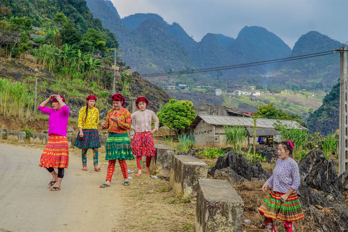
The geopark isn’t just about rocks — it’s also home to over 17 ethnic groups, each with their own way of life shaped by the highland terrain. You’ll find stilt houses, clay homes, colorful woven clothing, and local farming techniques that have existed for generations. This blend of geology and human culture is a big part of why the area received UNESCO recognition.
As you travel through the plateau, you’ll pass through many villages — some right by the roadside, others hidden in valleys. Villages like Sung La, Ma Le, and Pho Bang are worth slow visits. You don’t need a guide to appreciate the culture, but staying in a real local homestay or walking through a morning market makes the experience far more personal. Respect local customs, ask before taking photos, and take your time.
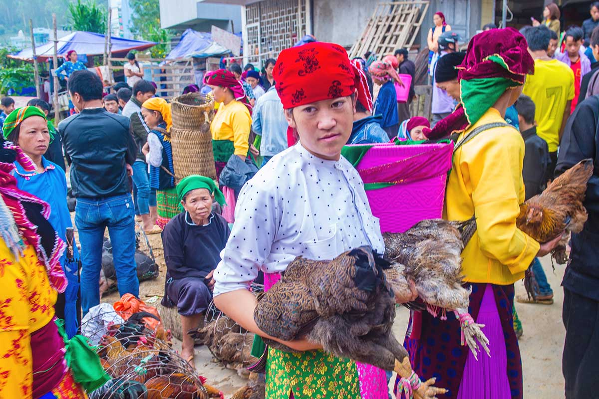
3. Weekend markets (Dong Van & Meo Vac)
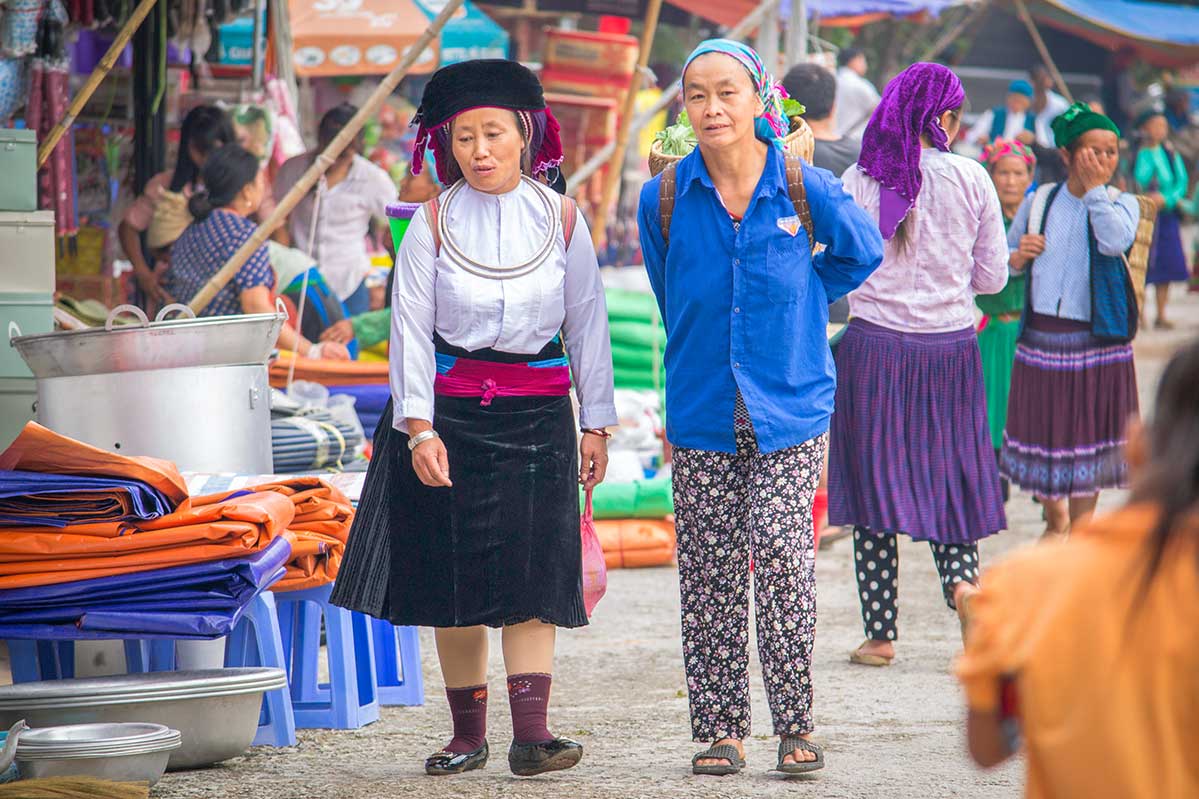
Markets in the geopark aren’t just for shopping — they’re major social gatherings that reflect the area’s cultural diversity. Held once a week, usually on Sundays, these markets draw people from all over the region, dressed in their traditional clothing and carrying goods to sell or trade. You’ll see livestock, handwoven fabrics, herbal medicine, and local produce — often brought in on foot or motorbike from remote villages.
Dong Van Market takes place on Sunday mornings in the town center and is easy to reach if you’re staying overnight. Meo Vac’s market, also on Sundays, is a bit bigger and more chaotic — worth visiting if your Loop itinerary aligns. Arrive early (before 9:00 am) to catch the most action. Even if you’re not shopping, it’s a great chance to witness daily life, take photos, and grab a bowl of hot noodle soup alongside local families.
4. Hmong King’s Palace (Vuong Family Mansion)
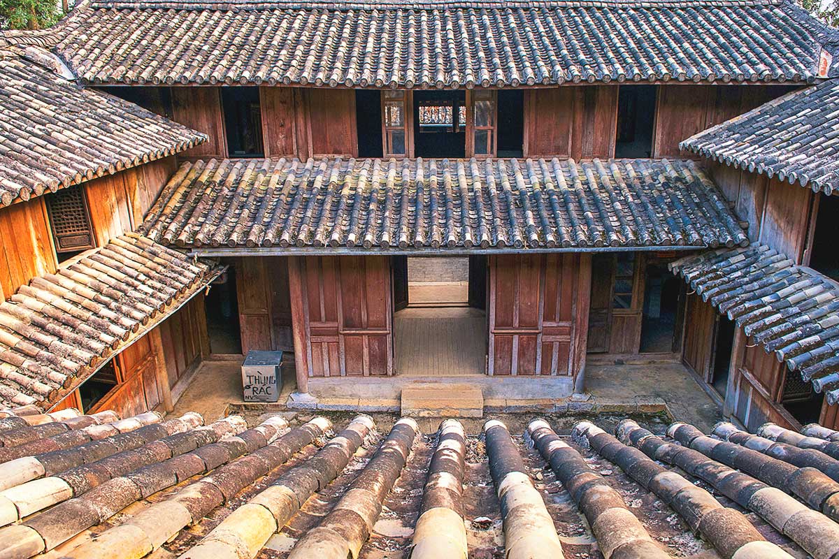
Hidden in a quiet valley in Sa Phin, the Hmong King’s Palace was the residence of Vuong Chinh Duc, a powerful Hmong leader during the French colonial era. The mansion blends Chinese, French, and Hmong architecture, with stone courtyards, carved wooden pillars, and traditional tiled roofs. It’s one of the most iconic cultural sites in the geopark, showcasing the influence and autonomy the Hmong once held in this region.
You can walk through the preserved rooms, including living quarters, opium storage areas, and ceremonial halls. It’s not very large, but the history is interesting and the setting is peaceful. Entrance is ticketed (usually under 20,000 VND), and it’s located just off the Ha Giang Loop, making it a quick and worthwhile stop between Yen Minh and Dong Van.
5. Lung Cu Flag Tower
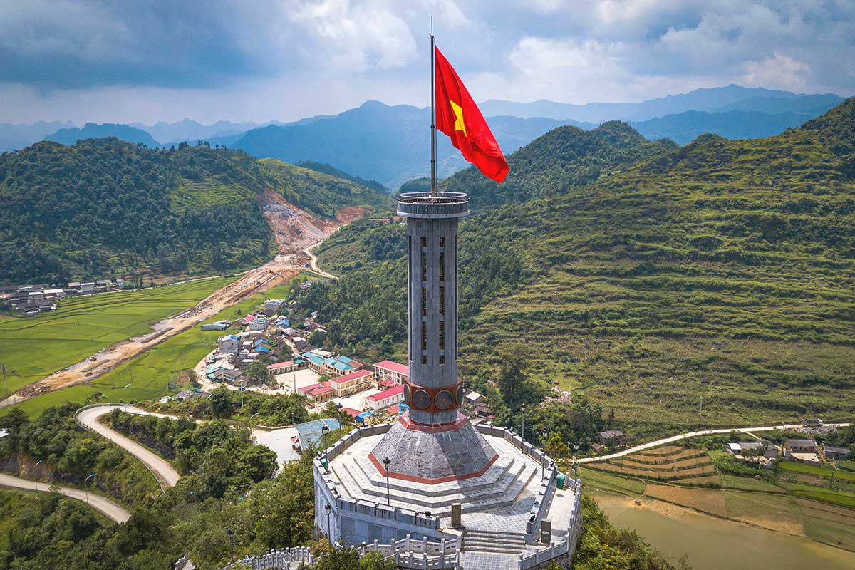
Lung Cu Flag Tower marks Vietnam’s symbolic northernmost point, sitting on top of Dragon Mountain (Long Son). The large red flag flying here represents national pride and unity, especially given its location just a few kilometers from the China border. From the top, you’ll get sweeping views of karst peaks, terraced fields, and remote villages.
To reach the flag tower, you’ll need to climb around 400 steps from the parking area — it’s not difficult, but bring water and sun protection if it’s hot. While the flag itself is the main attraction, the journey through the surrounding area is just as scenic. Combine it with a loop through local Lolo and Hmong villages for a deeper cultural experience.
6. Dong Van Old Quarter
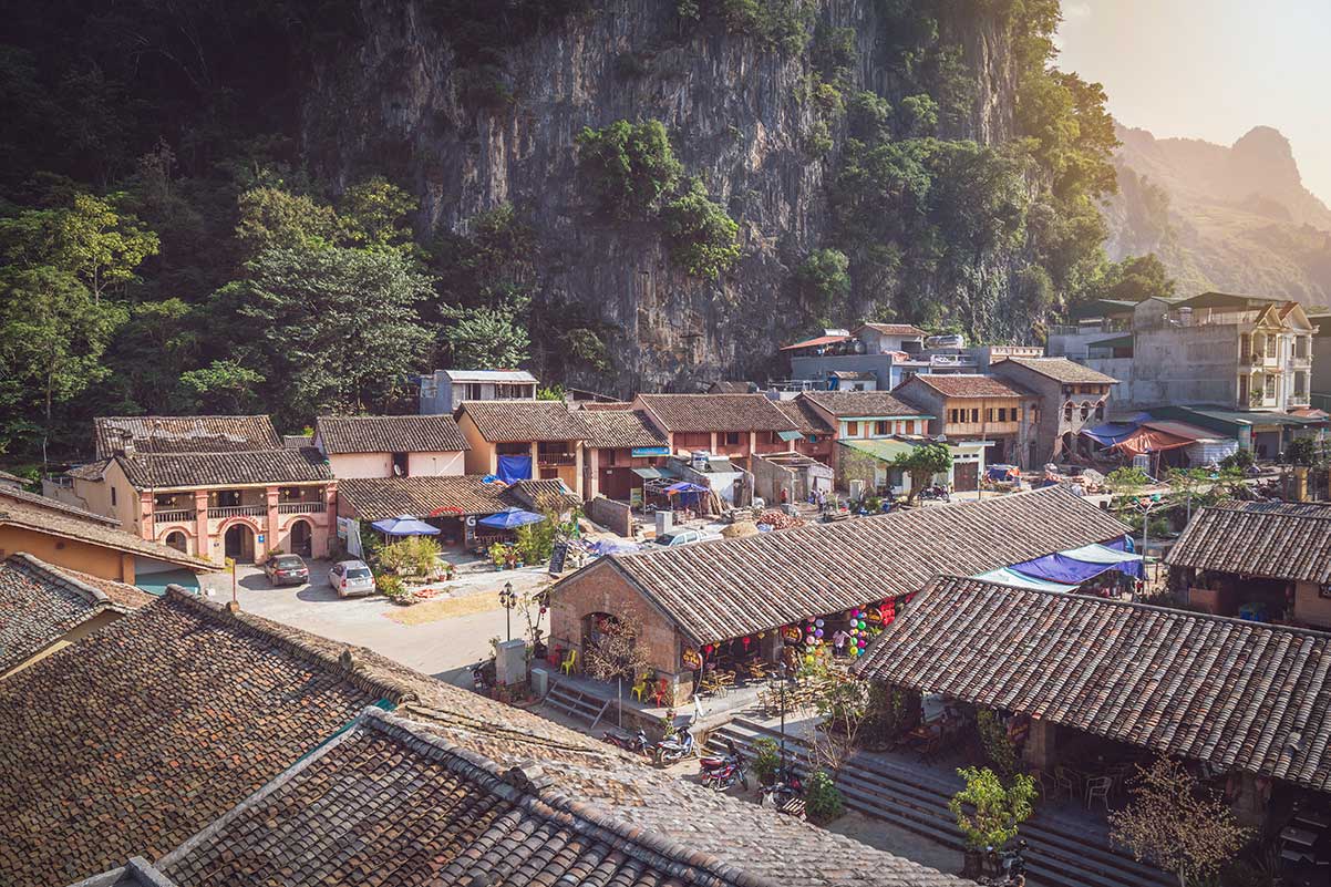
Dong Van Old Quarter is a small cluster of old houses tucked into a narrow valley, blending Vietnamese, Hmong, and French colonial influences. Some buildings date back over 100 years, with faded wooden facades, yellow walls, and tiled roofs. It’s not a large area, but it offers a rare glimpse into how communities adapted architecture to the harsh mountain climate.
The quarter is most lively in the evening or early morning. There are small coffee shops, noodle stalls, and local guesthouses built into the historic structures. If you’re there on a Saturday night, there’s often a low-key local market or street gathering. It’s a good base for the night and a relaxing spot to walk around after a long day of riding.
7. Tham Ma Pass
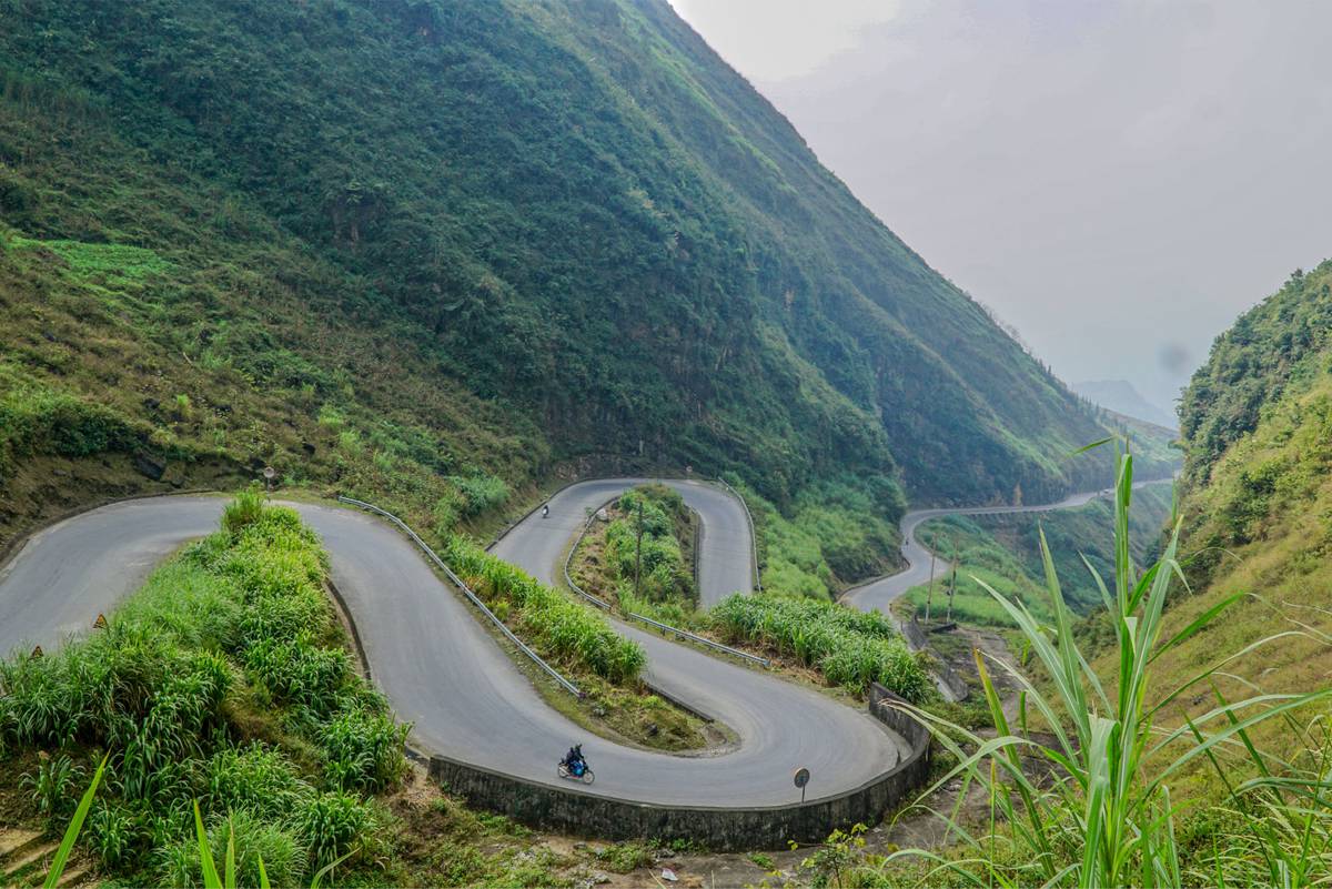
Tham Ma Pass is a short, steep section of road known for its tight S-shaped curves climbing through the hills. It’s one of the most photographed bends along the Ha Giang Loop, especially from the viewpoint at the top. Though not as vast as Ma Pi Leng, it’s still a great showcase of the region’s layered limestone formations and terraced valleys.
It’s located between Yen Minh and Dong Van, and you’ll likely pass through it without detouring. Stop at the top for a photo, or just enjoy the challenge if you’re driving or riding it yourself. Early morning light or late afternoon shadows make the views even better.
8. Sung La Valley
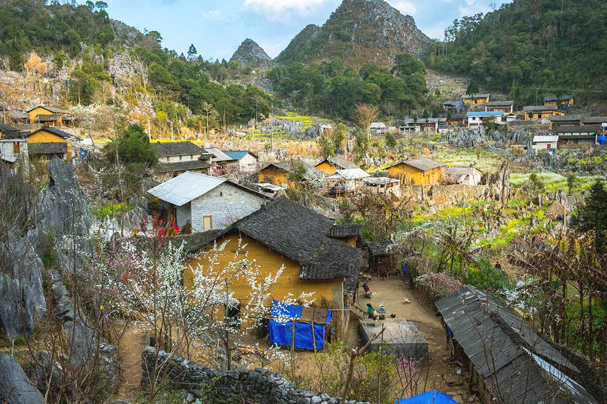
Sung La Valley is one of the greenest and most photogenic parts of the geopark. Surrounded by karst peaks and scattered with traditional Hmong homes, it’s known for its flower fields — especially in spring when the mustard blooms cover the ground in yellow. The village itself was also a filming location for the well-known Vietnamese movie Pao’s Story.
You can stop by the small house used in the film (there’s a small fee to enter), stroll through the flower paths, or just take in the views. The valley is a quiet contrast to the dramatic passes — a good place to slow down. It’s located just off the main road between Yen Minh and Dong Van.
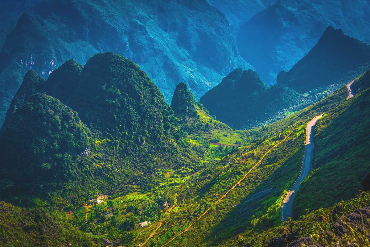
9. Nho Que River
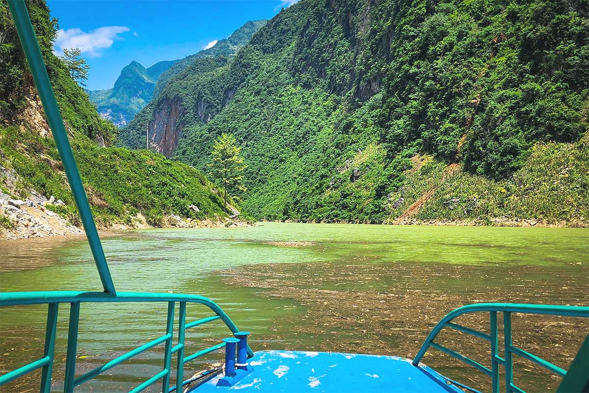
Flowing deep below Ma Pi Leng Pass, the Nho Que River is one of the most striking natural sights in the geopark. Its emerald water winds through the Tu San Canyon, often considered the deepest canyon in Vietnam. The river cuts sharply between limestone cliffs, forming a dramatic geological feature that represents millions of years of Earth’s shifting plates.
Many travelers now take a detour down to the river, either by motorbike or via a steep walking path (depending on access). From there, you can take a boat ride through the narrow canyon — calm, quiet, and scenic. It’s best visited in the dry season (October to May) when the river is most vibrant and the water levels are ideal for boating.
10. Quan Ba Heaven Gate & Twin Mountains
Quan Ba Heaven Gate is the first major viewpoint as you enter the geopark from Ha Giang City. It’s a high mountain pass that opens up to sweeping views of karst peaks, valleys, and the unique Twin Mountains (often nicknamed the “Fairy Bosom Hills”). This gateway marks the border between the lowlands and the start of the high karst plateau.
There’s a marked viewpoint and rest stop here, making it a natural first stop on the Ha Giang Loop. On a clear day, you’ll get beautiful views of terraced hills and dramatic rock formations. It’s also a great place to stretch your legs and take photos before continuing deeper into the loop.
How to visit the Geopark
Dong Van Karst Plateau Geopark is best explored as part of the Ha Giang Loop, a circular route through the mountains that usually takes between 3 and 5 days. The journey starts from Ha Giang City, the main gateway to the region, and passes through key districts like Quan Ba, Yen Minh, Dong Van, and Meo Vac.
Tip: Or book a tour with transfers included
Want to explore the geopark without the stress of driving? Check our Dong Van Karst Plateau Geopark tours — with guides, transport, and accommodation all arranged, so you can focus on the scenery.
There are a few different ways to travel the Loop, depending on your comfort level, experience, and budget.
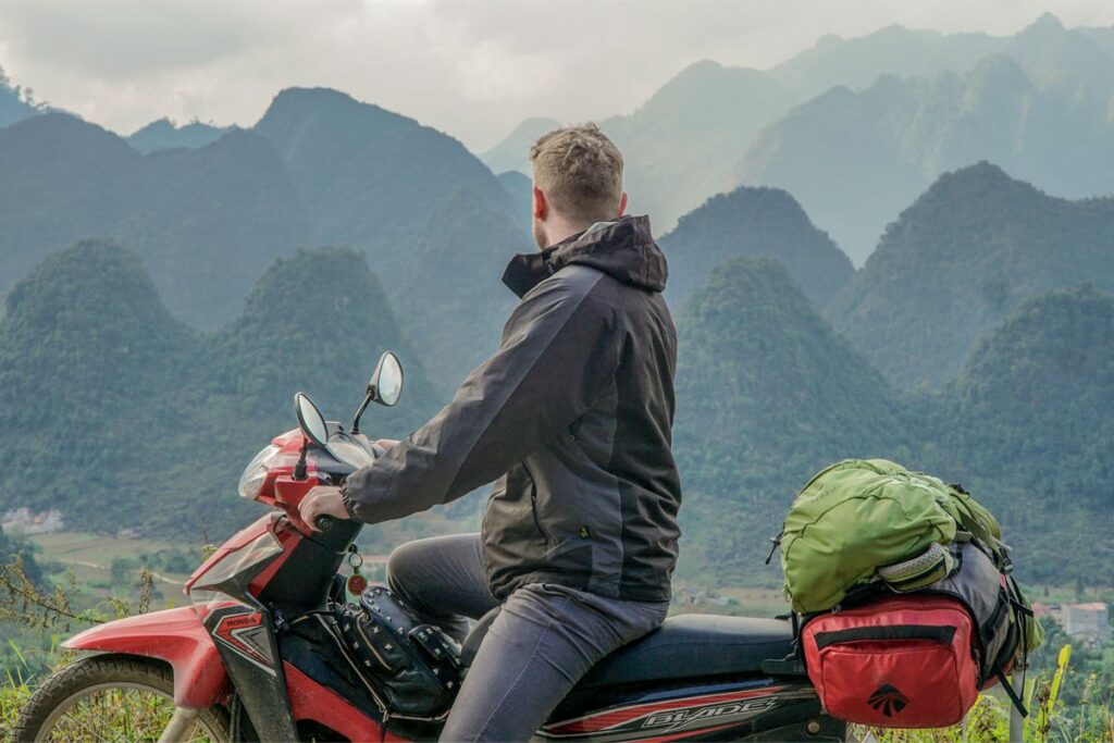
Motorbike Self-Driving
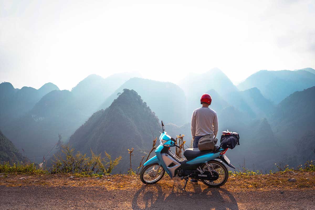
Riding a motorbike yourself is the most adventurous way to explore the geopark — and also the riskiest. The roads are steep, narrow, and winding, with sharp turns and frequent patches of fog. If you have limited riding experience, this option is not recommended.
That said, if you’re confident and experienced, the ride is unforgettable. Motorbike rentals are available in Ha Giang City, along with safety gear. Make sure to bring your license and register for a travel permit (which most rental shops can help with).
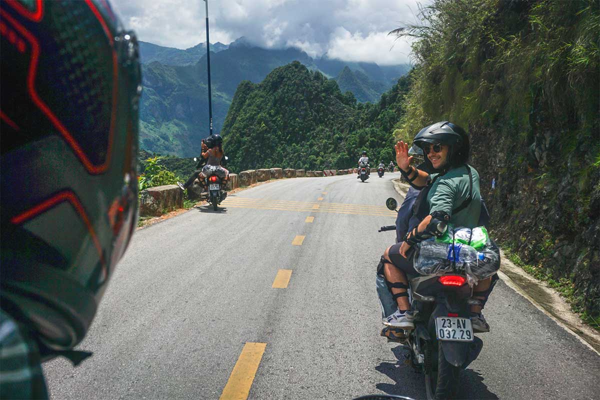
Guided motorbike tour (on the back)
If you want the thrill of a motorbike without having to drive, a guided motorbike tour with an easy rider is a great option. You’ll ride on the back of a motorbike with a local guide who knows the roads, the best viewpoints, and the cultural stops.
This is a popular choice for solo travelers or couples looking for a local experience with less stress. All logistics — bike, driver, accommodation, and fuel — are usually included in the tour package.
Ha Giang Loop Tour in 3 days by Easy Rider
- Experience: Ride pillion with a local guide through Vietnam’s most dramatic mountain landscapes.
- All-Inclusive: Includes Hanoi transfers, meals, and 2 nights’ accommodation along the loop.
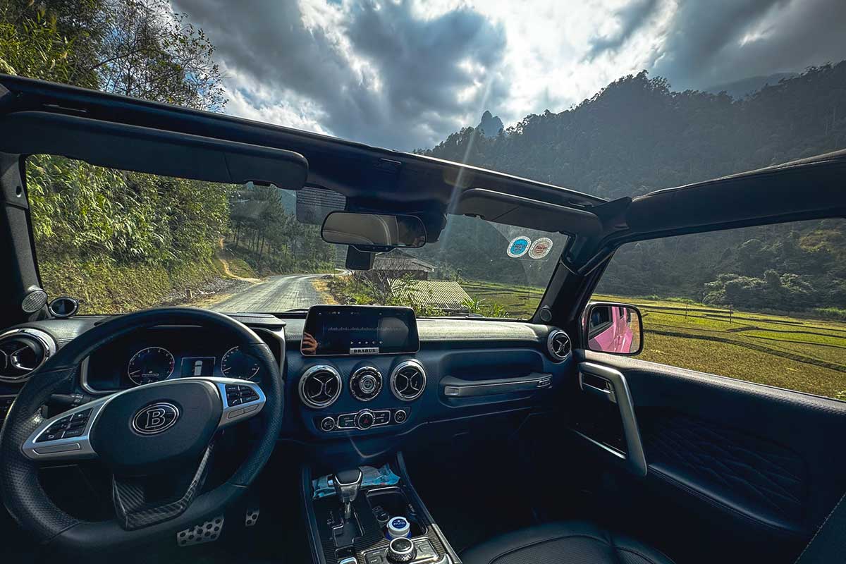
Car or jeep with driver
For comfort and safety, traveling by car or jeep with a private driver is the easiest option — especially for families, older travelers, or during bad weather. You still get the views, stops, and cultural experiences, but without the fatigue of riding.
This option is usually part of a guided tour, often with a local guide who explains the region’s geology and culture. Private car tours from Hanoi or Ha Giang can be arranged for 3–5 day itineraries, and often include permits, hotels, and entrance fees.
Ha Giang Loop Tour in 3 days by Car or Jeep
- Experience: Explore Ha Giang’s mountain roads in comfort by private car or jeep.
- Includes: Driver, accommodations, and all transfers from Hanoi—no planning needed.
When to visit Dong Van Karst Plateau
The best time to visit Dong Van Karst Plateau Geopark is during the dry months from March to May and September to November. During these periods, the weather is more stable, skies are clearer, and you’ll have the best visibility for enjoying mountain views, hiking, and photography. Spring also brings flower fields and green valleys, while autumn offers golden rice terraces and cooler air.
Try to avoid the rainy season from June to August, when heavy downpours can cause landslides, slippery roads, and blocked passes. Fog and cloud cover are also common, limiting visibility — not ideal for a scenic road trip.
From December to February, the region gets cold and misty, especially in the mornings and evenings. While it can be atmospheric, you’ll need to pack warm layers. This season is quieter, but also less colorful.
For more detail on weather, seasons, and monthly travel tips, check our full guide: Best time to do the Ha Giang Loop.
Where to stay in the Geopark
As you travel through the Dong Van Karst Plateau Geopark along the Ha Giang Loop, you’ll stay in different locations each night. Most routes follow a 3–5 day plan, with stops in key towns or scenic villages.
Dong Van Town
The most popular overnight stop, with a wide range of hotels, guesthouses, and cafes. It’s a good base for exploring the Old Quarter and Sunday market.
Meo Vac Town
A quiet town surrounded by mountains, often used as the second or third night stop. Basic but comfortable stays, and ideal for visiting the local market.
Homestays in Villages
For a more local experience, stay in traditional-style homestays in places like Sung La (inside the geopark) or Du Gia (often added to longer loops). Expect simple rooms, family meals, and peaceful surroundings.
Travel tips for the Geopark
Traveling through Dong Van Karst Plateau Geopark means long days on the road, remote villages, and fast-changing weather. Being well prepared will help you enjoy the journey more and avoid unnecessary stress. Here are a few practical tips:
Pack for all conditions
The weather can shift quickly between valleys and mountain passes. Bring layers, a windbreaker, and sunscreen — even on cloudy days, the UV exposure can be high at altitude.
Bring enough cash
ATMs are only available in bigger towns like Ha Giang, Dong Van, and Meo Vac. Most homestays, shops, and markets only accept cash, so withdraw in advance and carry small notes.
Fuel up regularly
Gas stations are not always available in remote areas. Top up whenever you see one — especially before leaving larger towns. Some small shops also sell bottled petrol if you’re stuck.
Use a Vietnamese SIM and Offline Maps
A local SIM card helps with navigation and emergencies, but don’t rely on mobile signal everywhere. Download offline maps (like Google Maps or Maps.me) before your trip.
Be ready for sudden weather changes
Rain, fog, or wind can appear without warning, especially at high elevations. Drive carefully, keep your rain gear accessible, and avoid riding after dark.
Respect local culture
The geopark is home to Hmong, Tay, Lolo, Dao, and other ethnic groups living traditional lives. Ask before taking photos, avoid loud or disrespectful behavior, and dress modestly — especially in villages and markets.