What is the Mai Chau Loop?
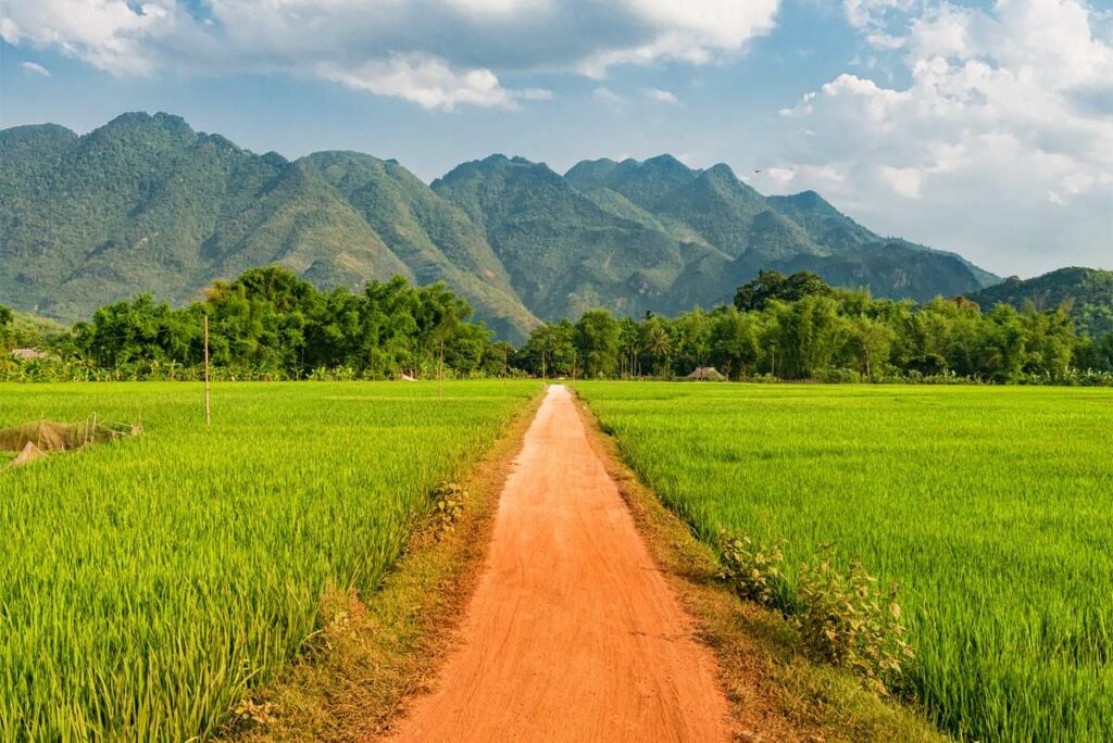
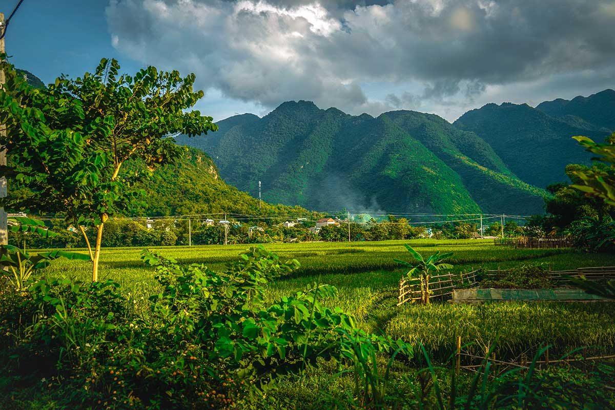
The Mai Chau Loop is a scenic day trip designed to show you a very different side of Mai Chau. While most travelers explore the flat rice paddies and villages around Lac Village, this loop takes you higher into the hills, along mountain passes, lakeside roads, and through small ethnic villages.
Unlike longer adventures such as the Ha Giang Loop, this route is compact and can be done in half a day with short stops, or turned into a full-day outing with activities like climbing to a cave viewpoint, kayaking on Hoa Binh Lake, or relaxing at a waterfall.
It’s not an official route — it’s a custom loop we created for travelers who want to go beyond the typical Mai Chau experience. If you’ve already cycled around the valley and are looking for something new, the Mai Chau Loop is your best next step.
Overview of the Mai Chau Loop
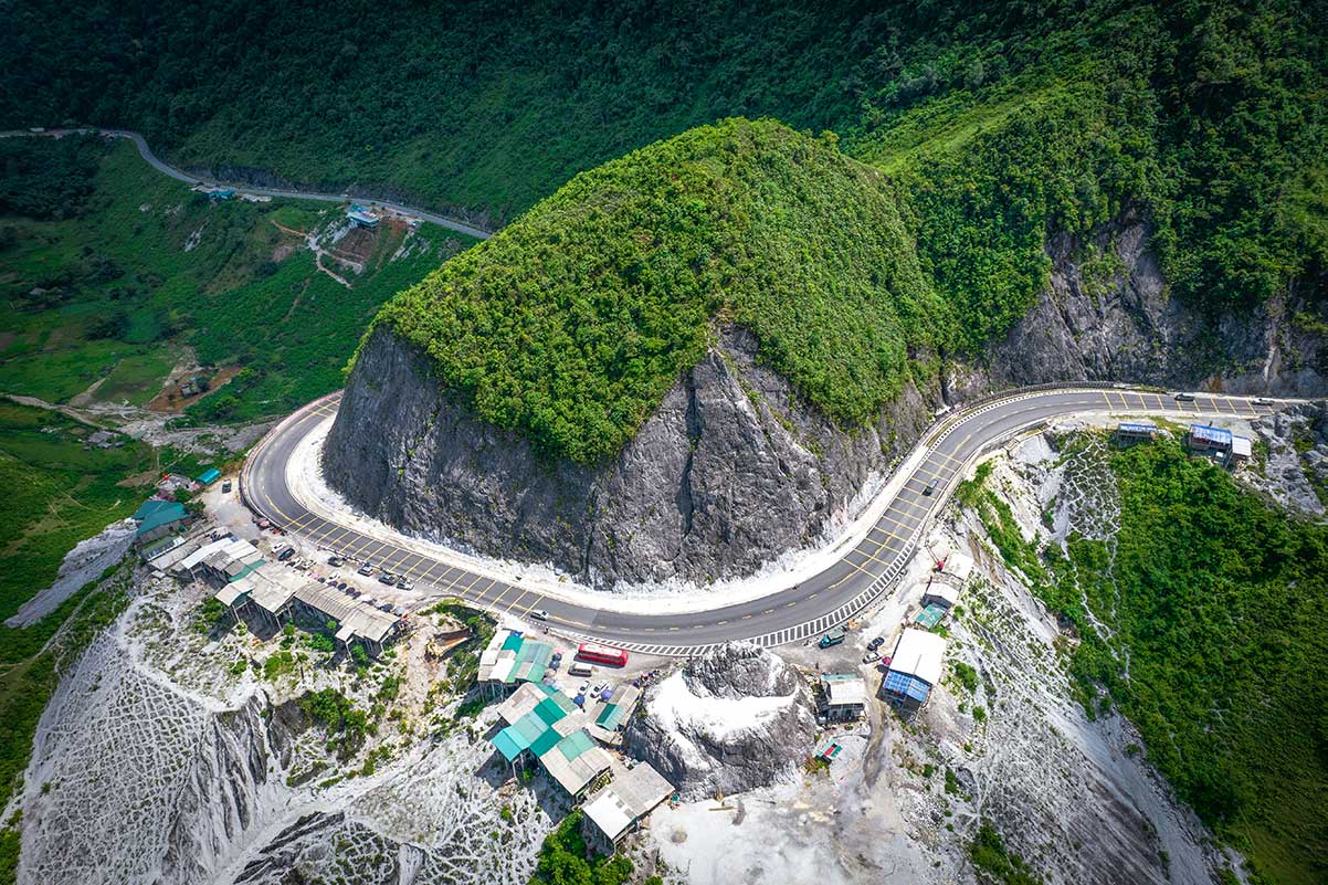
Total distance: Approximately 63 km
Estimated time:
– With short scenic stops: 3–4 hours
– With activities like cave climbing, kayaking, or a boat ride: 5–7 hours
Scenery highlights: Mountain passes, lake views, rice fields, stilt houses, and forested areas
Road conditions:
– Main highway section (up Thung Khe Pass): Smooth and fully paved
– Lakeside backroads: Narrower, occasional potholes, and a few steep or winding stretches
Route map: Google Maps link
How to drive the Mai Chau Loop
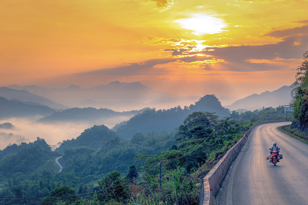
The Mai Chau Loop involves steep climbs and winding roads, so it’s not suitable for bicycles unless you’re extremely fit and equipped with a high-quality bike. The best ways to do the loop are by motorbike, riding on the back of a local’s bike, or with a private car and driver.
Motorbike or scooter
Riding a motorbike gives you the most freedom to stop wherever you like and enjoy the scenery at your own pace. It’s ideal if you’re confident on steep, curvy mountain roads. Keep in mind that the backroads along the lake can be narrow with potholes, so drive cautiously.
On the back of a motorbike
There are no official Easy Rider tours in Mai Chau, but most local families can take you around on the back of their bike. It’s a great option if you’re not comfortable driving yourself but still want the full local experience. Just ask your homestay — they’ll likely know someone who can take you.
Car with driver
Perfect for travelers who don’t ride motorbikes or prefer more comfort. You’ll still be able to visit all main highlights, although you may have fewer opportunities to stop spontaneously. Cars with drivers aren’t always readily available in Mai Chau, so it’s smart to arrange this at least a day in advance.
Rent a car in Mai Chau for a scenic loop
Don’t ride a motorbike? We can help arrange a private car and driver so you can enjoy the Mai Chau Loop safely and comfortably.
The Mai Chau Loop route
The Mai Chau Loop is a scenic circular route of about 63 km that starts and ends in Lac Village or nearby homestays. It takes you over a mountain pass, through ethnic villages, past lake viewpoints, waterfalls, and ends with a peaceful lakeside retreat.
Below are the 7 main stops along the loop, including practical info and travel time estimates. This section will help you plan your route and decide where to stop — whether you want a full day of activities or just a few photo breaks.
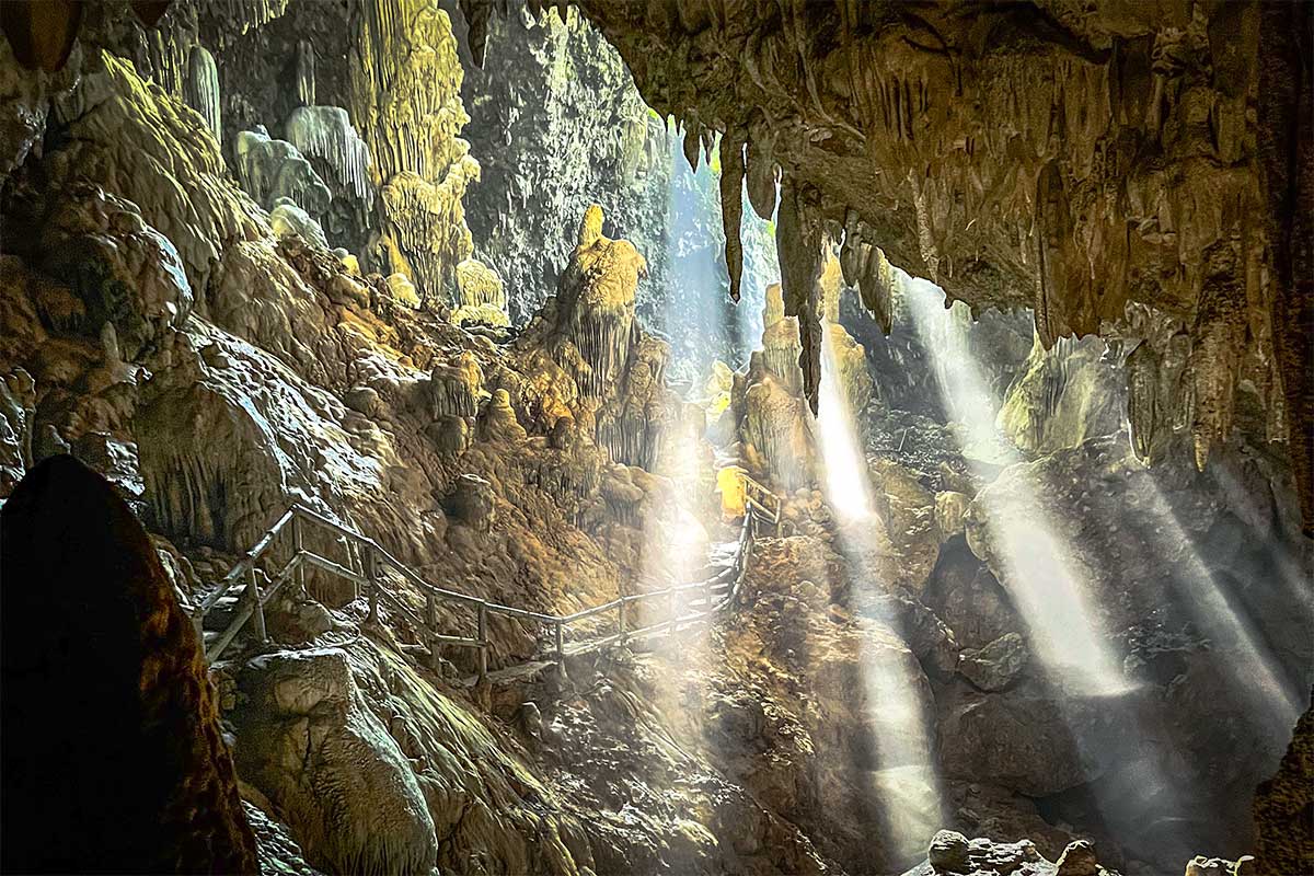
Stop 1: Chieu Cave
- Travel time from Lac Village: ~15 minutes
- Time needed: 45 minutes – 1 hour
The loop begins from Lac Village, where most travelers stay — either in a traditional stilt house inside the village or at a lodge nearby. From here, it’s a short ride through the rice fields to the main road. After a couple of minutes, turn right onto a small paved road that leads to a dead end. This is where you park your motorbike and begin the stair climb to Chieu Cave.
The path is steep, with about 1,200 stone steps winding uphill through the trees. It’s a bit of a workout, but once you reach the top, you’ll be rewarded with wide views over the valley. The cave itself is large and atmospheric, with tall limestone formations and minimal lighting — still quite natural and not overly developed. It’s a peaceful, scenic place to begin your day before heading up into
See our full Chieu Cave guide for tips
Stop 2: Mai Chau Viewpoint (Thung Khe Flagpole)
- Travel time from Chieu Cave: ~20 minutes
- Time needed: 10–15 minutes
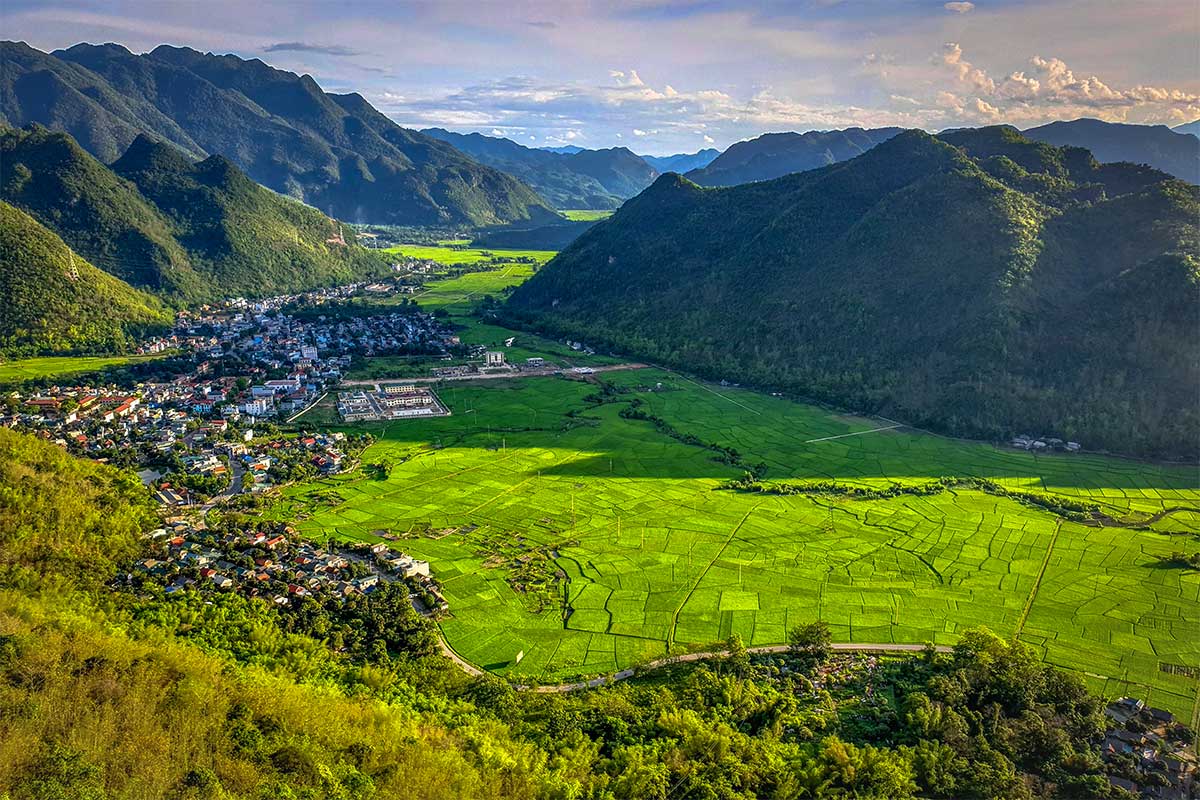
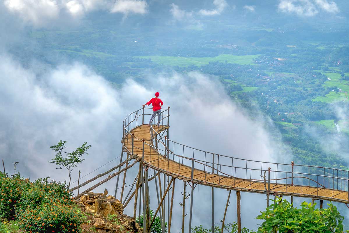
From Chieu Cave, ride back to the main road and continue straight for about 6 km. At the intersection where the road to Moc Chau goes straight, you turn right to begin the climb up Thung Khe Pass. After around 3.5 km of uphill driving, you’ll see a flagpole and a small roadside café on your right — this is the Mai Chau Viewpoint.
It’s one of the best places to see the full scale of the Mai Chau Valley laid out below — rice fields, stilt houses, and green hills stretching into the distance. There’s usually a local vendor selling drinks or snacks, and a small parking area where you can safely stop. A short but rewarding pause before heading deeper into the mountains.
See our full Mai Chau Viewpoint guide
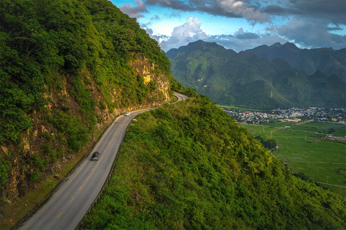
Stop 3: White Rock Pass (Thung Khe Market)
Travel time from Mai Chau Viewpoint: ~15 minutes
Time needed: 20–30 minutes
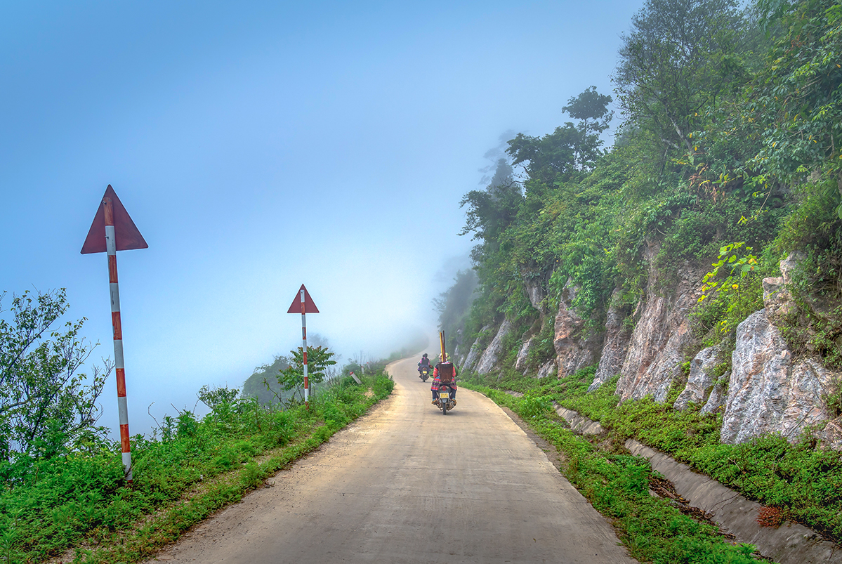
From the Mai Chau Viewpoint, continue along the pass for around 8 km. This stretch of road is part of Thung Khe Pass, known for its winding curves and beautiful scenery. If you’re on a motorbike, there are several spots along the way where you can slow down or stop to enjoy the views. These are all on the left side of the road — the mountain is on your right, and the valley views are on your left — so be extra careful when pulling over or parking.
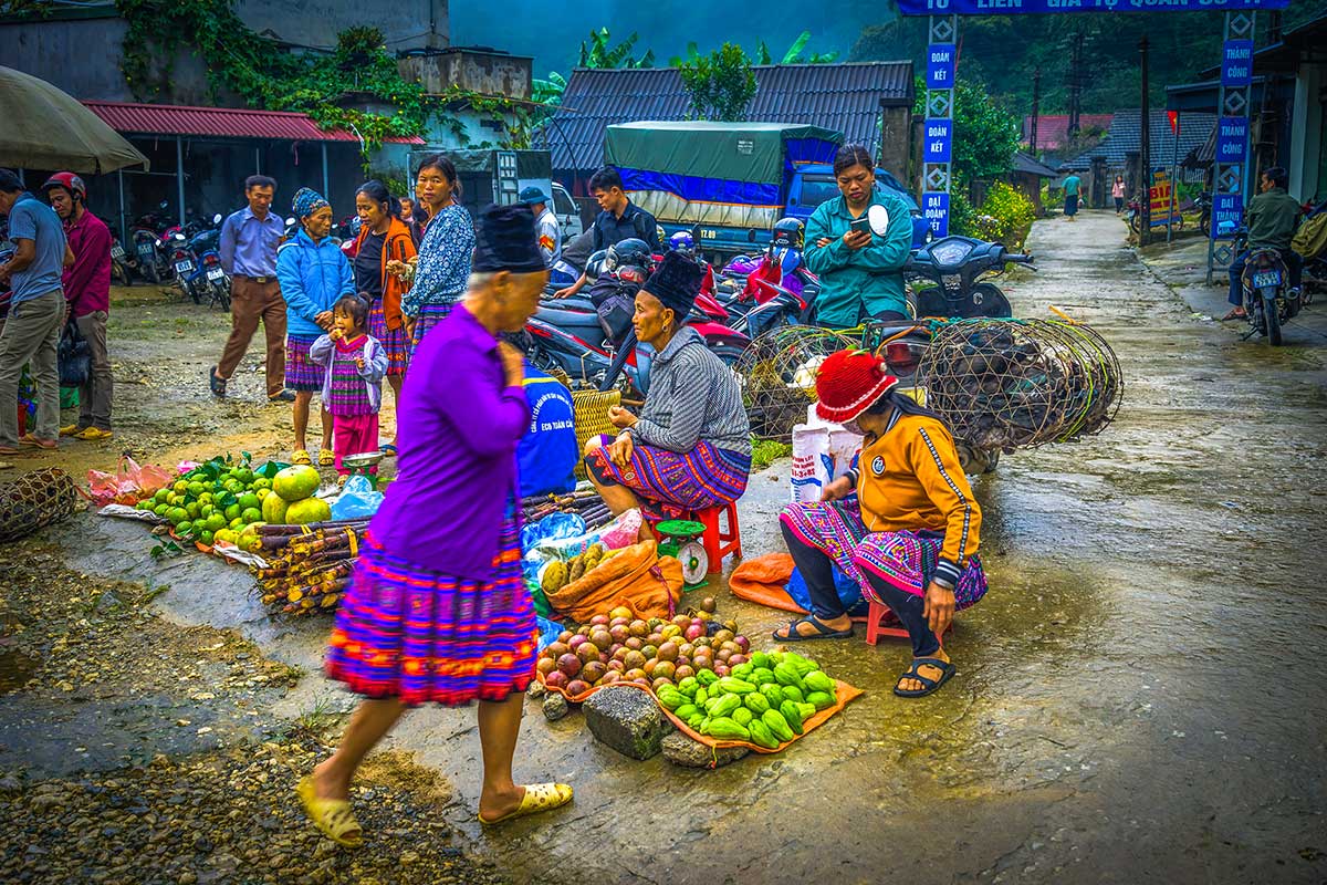
Eventually you’ll reach a wider open section with pale limestone cliffs — this is White Rock Pass. On the right side, you’ll find a group of simple roadside stalls known as Thung Khe Market, selling boiled corn, bamboo sticky rice, and tea. It’s a popular rest stop with plenty of space to park and stretch your legs. This is your last break before turning off the main highway and heading into quieter backroads through ethnic villages.
See our full Thung Khe Pass guide for more tips.
Stop 4: Local Villages (Scenic Drive)
Route: From Thung Khe Market to Sunset Viewpoint
Time needed: 10–15 minutes (or just enjoy the ride)
After your break at Thung Khe Market, continue on the main road for about 2.5 km. Here, you’ll see a small road on the left — this is where you leave the highway and enter a quieter, more local part of the loop. The road winds through several small ethnic villages with stilt houses, rice fields, and dense greenery.
There’s not one specific stop here, but it’s a very scenic stretch worth slowing down for. The area is home to Hmong communities, and while you probably won’t see much tourist infrastructure, the charm is in the landscape and village atmosphere. You’ll pass through forests, farm fields, and quiet backroads — a peaceful contrast to the busier mountain pass you just left behind. This road gradually curves back toward Mai Chau, but from a much lower elevation.
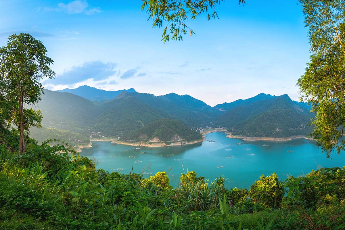
Stop 5: Hoa Binh Lake Viewpoints & Boat Ride
Travel time from Thung Khe Pass: ~45 minutes
Time needed:
– Viewpoints: 10–15 minutes
– Optional boat ride: 1.5–2 hours
Continue driving along the local road for around 45 minutes. The route passes through quiet countryside, forested areas, and small villages before reaching the shores of Hoa Binh Lake. This part of the loop is especially scenic — the road hugs the lake in sections and offers several great places to stop for views.
One well-known stop is Sunset Viewpoint (marked on Google Maps), but you’ll find multiple spots along the road with panoramic views over the water and surrounding hills. It’s not about one perfect photo stop — the whole area is worth taking slow.
There are also a few basic boat docks along this road where you may be able to arrange a short ride on the lake. These places are small and not clearly marked from the road, but you can find them on Google Maps by looking for locations that include “Bến tàu”, which means wharf in Vietnamese. It’s not a major boat tour area, but if you’re lucky, you can join a simple lake trip — a peaceful detour if you have time.
For more details on how to arrange a boat and what to expect, see our full Hoa Binh Lake guide.
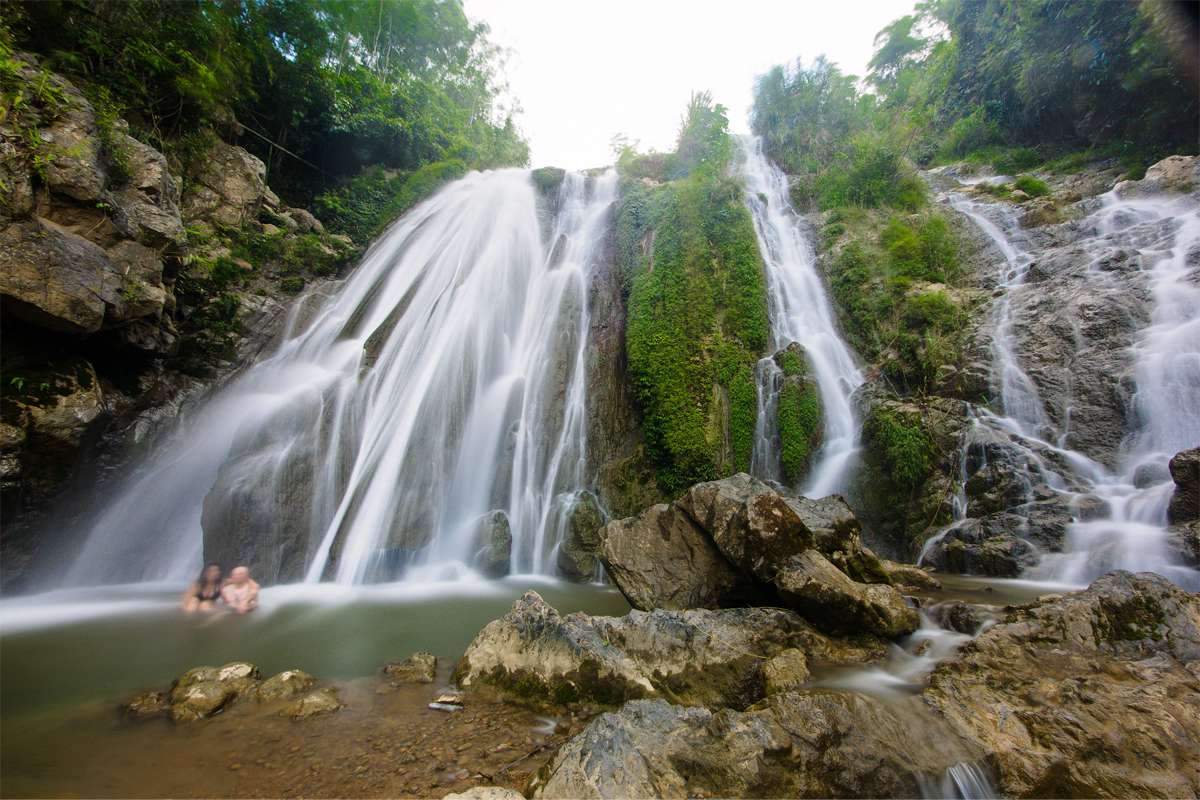
Stop 6: Go Lao Waterfall
Travel time from Sunset Viewpoint: ~20 minutes
Time needed: 30–45 minutes
Continue along the lakeside road for another 20 minutes to reach Go Lao Waterfall. There’s a small parking area near the entrance, and from there it’s just a short walk down a dirt path to the falls.
The waterfall isn’t large, but it’s a beautiful spot — especially after recent rain when the flow is stronger. Water pours down a rocky wall surrounded by greenery, forming a shallow natural pool at the base. It’s not really a swimming spot, but you can take a quick dip or cool off your feet. The area is mostly quiet, great for photos, and a refreshing break before the final stretch of the loop.
See our full Go Lao Waterfall guide for tips and directions.
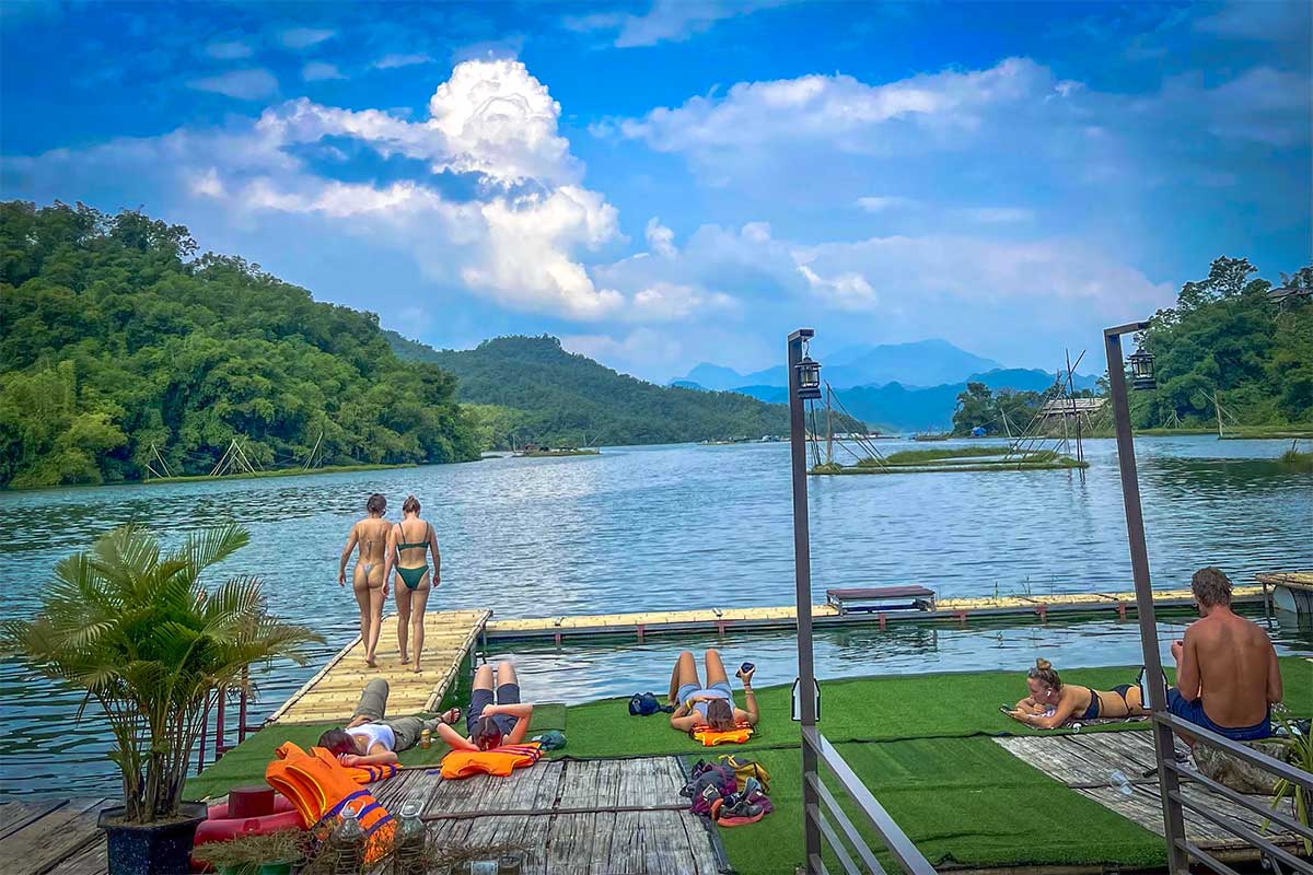
Stop 7: Mai Chau Floating House
Travel time from Go Lao Waterfall: ~5 minutes
Time needed: 1–2 hours (depending on activities)
From Go Lao Waterfall, it’s just a short 5-minute drive to Mai Chau Floating House, located right on the edge of Hoa Binh Lake. It’s a peaceful, lakeside stop with a floating structure that serves as a small restaurant and chill-out spot.
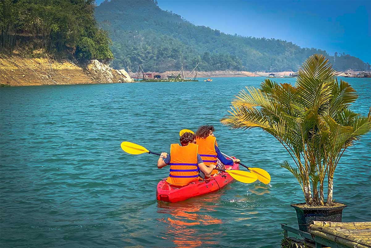
You can come here just to relax — have a drink, enjoy the view, or lie in the sun. But it’s also one of the best places in the area for kayaking or paddleboarding. Rentals are available on-site, and you can head out onto the calm lake for a short paddle or spend a few hours exploring. It’s a great way to end your loop, especially if you want to wind down after a day of riding.
See our full Kayaking in Mai Chau guide for prices and route tips.
From the Floating House, it’s about 14 km back to Lac Village — roughly a 30-minute drive. The road starts off small and local before reconnecting with the main highway between Mai Chau and Moc Chau. This last section completes the loop and brings you right back to where you started.
Tips for driving the Mai Chau Loop
To make the most of your adventure, it’s worth preparing a few things in advance. The Mai Chau Loop takes you through rural areas with limited services, so a little planning goes a long way.
Drive with caution
Some sections are winding, steep, or narrow — especially around the pass and lakeside road. Take your time, especially in bad weather or when crossing to viewpoints.
Bring cash
You’ll need it for cave entrance fees, drinks at the pass, snacks, boat rides, and kayak rentals near the floating house. ATMs are rare once you leave Mai Chau town, and card payments are almost never accepted.
Check the weather
Rain makes roads slippery, and clouds can cover the views at Thung Khe Pass. For both safety and scenery, it’s best to drive the loop on a clear day.
Pack swimming gear
Bring swimwear and a towel if you want to take a dip at Go Lao Waterfall or kayak near the floating house. Changing facilities are basic or nonexistent.
Protect yourself from the sun
Even when it feels cool, the sun can be intense. Use sunscreen, sunglasses, and wear long sleeves — especially during the midday drive across the pass.
Alternative route: Hang Kia & Pa Co Village
If you’re looking for a quieter, more off-the-beaten-track experience than the Mai Chau Loop, consider heading to Hang Kia and Pa Co Village instead. This route isn’t a loop — you’ll drive the same way in and out — but the scenery and atmosphere are very different.
Hang Kia sits high in the mountains and is known for its cloud-hunting views, pine forests, and traditional Hmong culture. It feels remote and authentic, with far fewer tourists than Mai Chau Valley.
Nearby Pa Co Village is also home to the Pa Co Sunday Market, a small but vibrant ethnic market where Hmong people from the surrounding area gather to trade.
To plan this route, read our guide to Hang Kia and learn more about Pa Co Market here.