
What is Ca Mau Cape?
Southernmost point of Vietnam
Ca Mau Cape is the last tip of mainland Vietnam, where the land narrows into the sea at the end of the Mekong Delta. For many Vietnamese, reaching this point is a symbolic journey — a kind of pilgrimage to stand at the edge of the country. It represents both national pride and the geographic “end of the land,” marked by official milestones and monuments.
Mui Ca Mau National Park
The cape is part of Mui Ca Mau National Park, a protected area of more than 40,000 hectares that was recognized by UNESCO as a World Biosphere Reserve in 2009 and listed as a Ramsar wetland site in 2013.
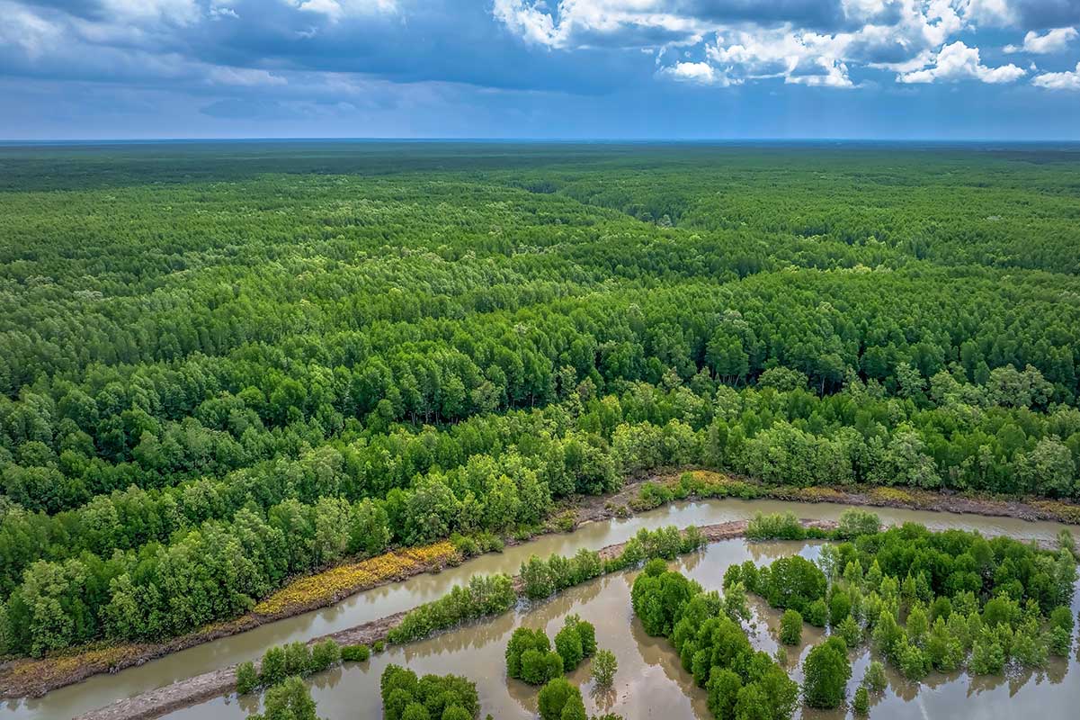
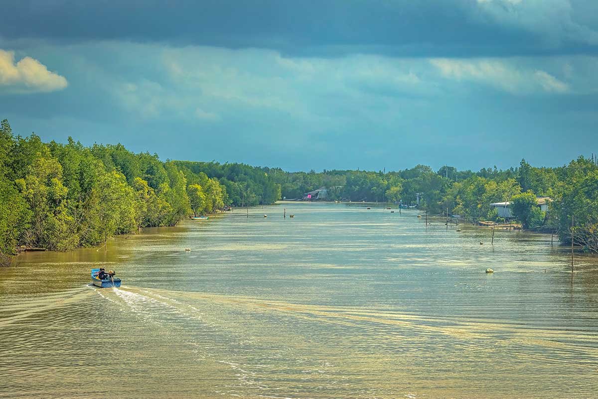
The park contains Vietnam’s largest mangrove ecosystem, shaped by both the East Sea and the Gulf of Thailand’s tidal regimes. It is home to migratory birds, fiddler crabs, mudskippers, fish, and shrimp, alongside endangered species such as long-tailed macaques and silvered langurs.
Today’s Ca Mau Cape
Today the cape is a mix of untouched nature, aquaculture, and tourism development. Local families still rely on shrimp ponds and fishing in the tidal creeks, while visitors encounter a growing number of monuments, a replica flag tower, and long sea embankments designed both for protection and sightseeing. This creates a sharp contrast: on one side, authentic mangrove wilderness and village life; on the other, heavily built symbolic structures that sometimes feel out of place in the natural landscape.
Highlights of visiting Mui Ca Mau National Park
Visiting Mui Ca Mau National Park means experiencing two very different sides of the same destination. On one side are the mangrove forests and waterways that form one of Vietnam’s richest wetland ecosystems.
On the other are symbolic landmarks and monuments, built to emphasize the cape’s national significance as the southernmost point of the country. Both elements shape the experience, for better or worse.
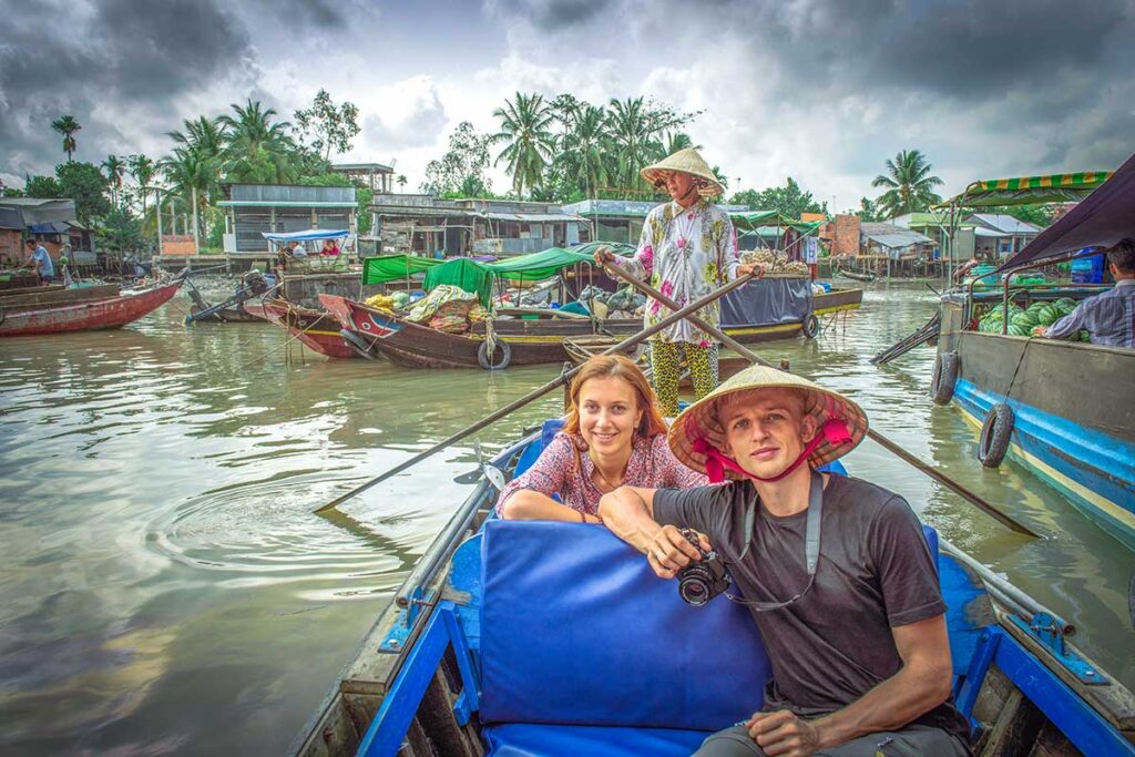
1. Boat rides through mangrove forests
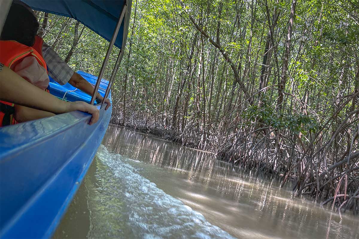
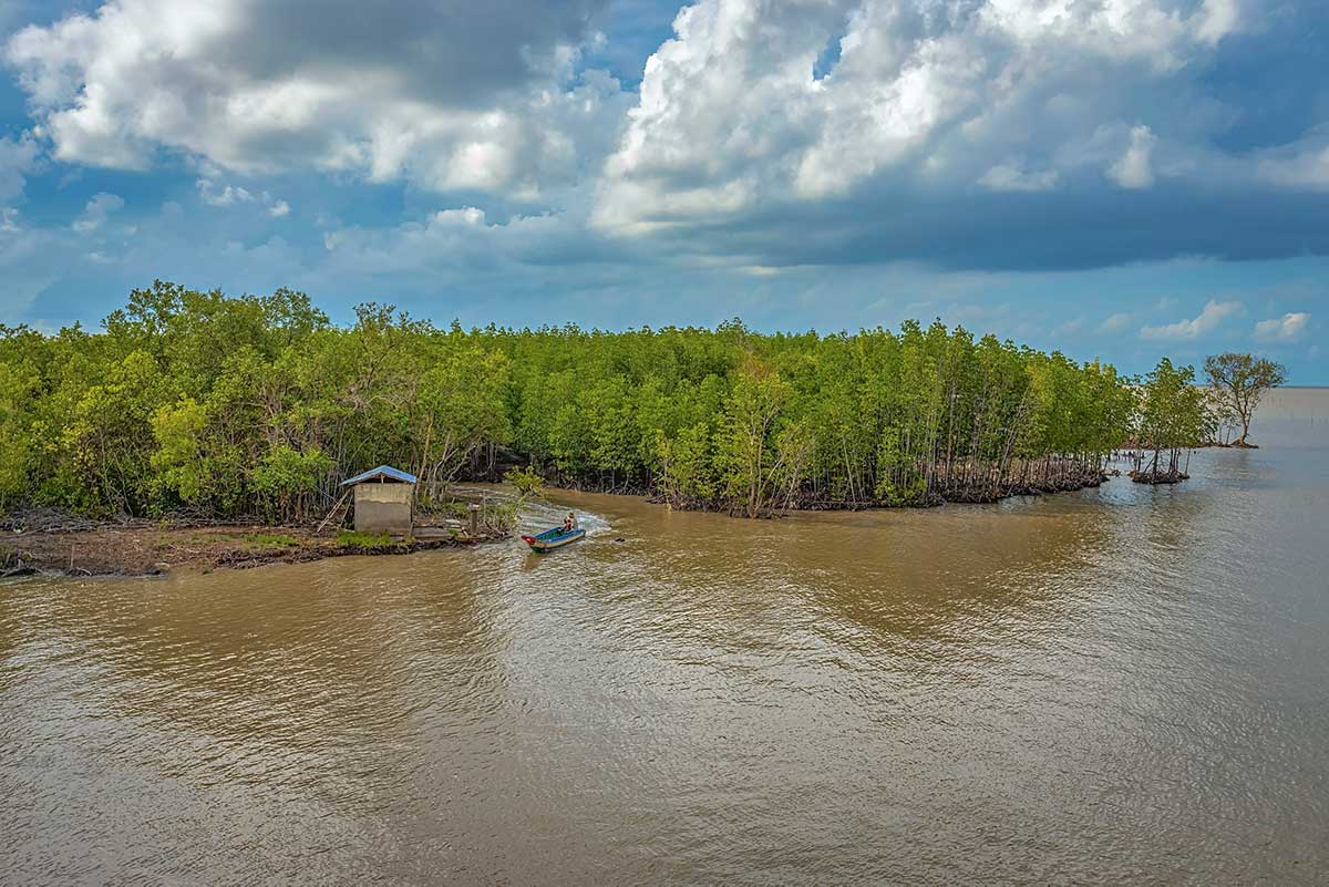
One of the most rewarding activities is exploring the waterways by canoe or motorboat, either from Nam Can or directly inside the park. These trips bring you deep into the mangroves, where you can watch flocks of migratory birds, see mudskippers crawling across the mud, or spot fiddler crabs waving their oversized claws. Along the canals, you will also notice aquaculture projects such as oyster cages and shrimp ponds that sustain local families.
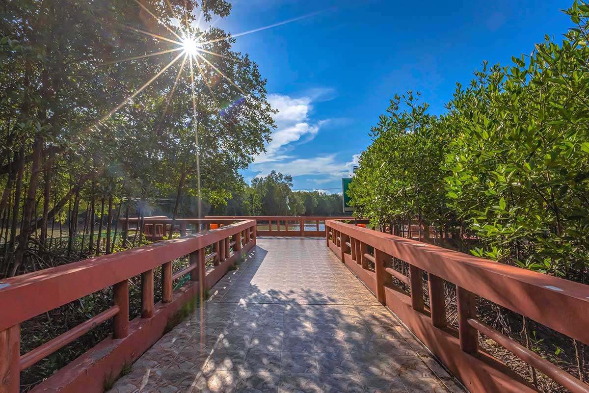
2. Walking paths through the mangroves
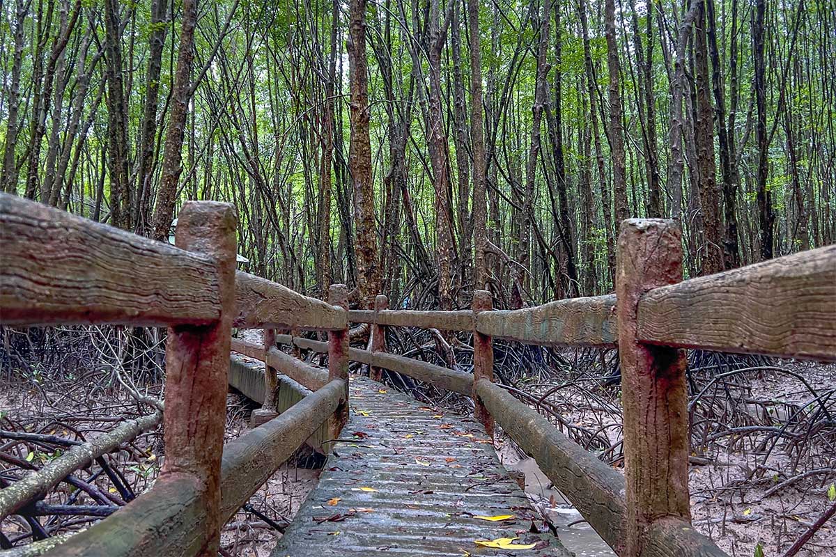
If you prefer to stay on land, several short trails and raised wooden walkways lead through the mangroves. These give a closer look at the twisted root systems and tidal mudflats that make this ecosystem unique. It’s a slower, quieter way to experience the park and better appreciate the resilience of mangrove forests.
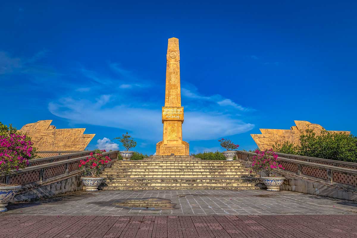
3. Flag Tower & Main Landmarks
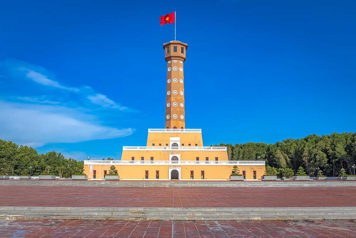
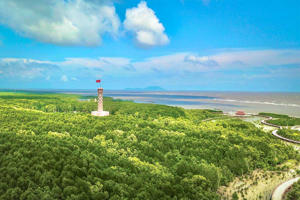
At the developed part of the cape, you’ll find the replica of Hanoi’s Flag Tower, built as a symbolic reminder of Vietnam’s unity from north to south.
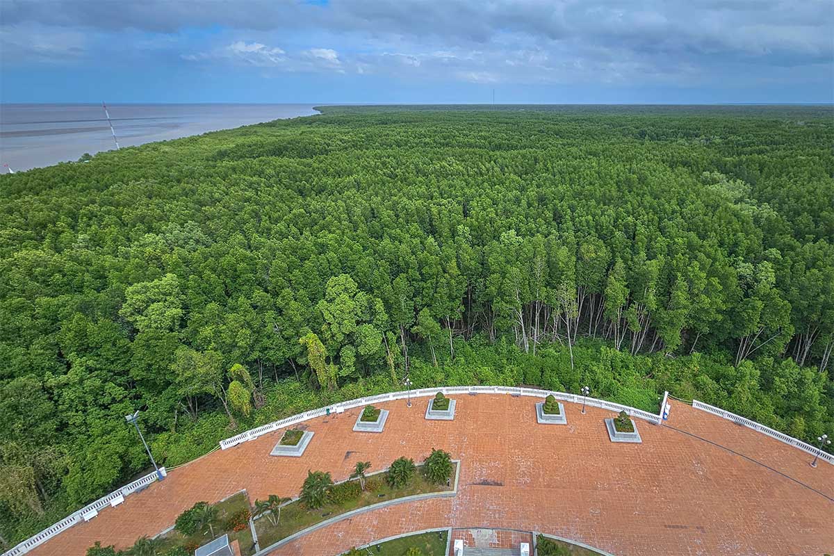
From the top, you get a panoramic view of the mangroves and the coastline. While some visitors feel it clashes with the natural setting, it has become the most photographed spot in the park and a key landmark for anyone making the journey to Vietnam’s southern tip.
4. Other Monuments & Markers
Beyond the flag tower, a cluster of symbolic landmarks has been built at the cape to highlight its national importance. For some visitors, these additions feel meaningful and patriotic, while others — both foreigners and Vietnamese — see them as an overdeveloped intrusion into a natural landscape that would be more powerful on its own. Either way, they have become part of the experience:
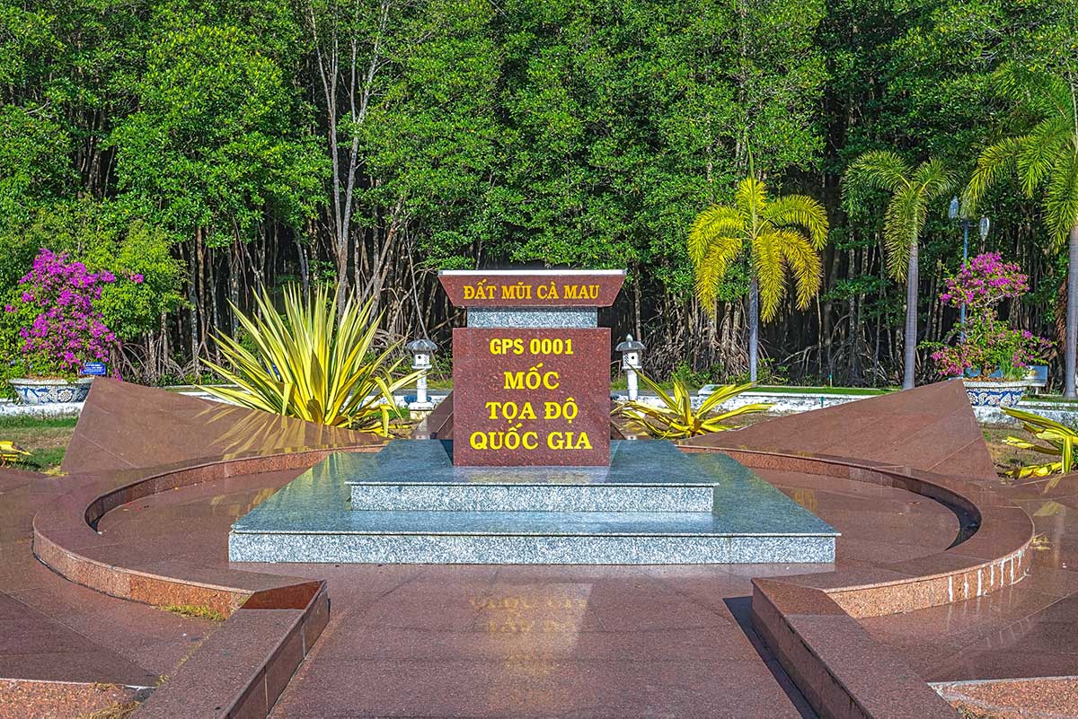
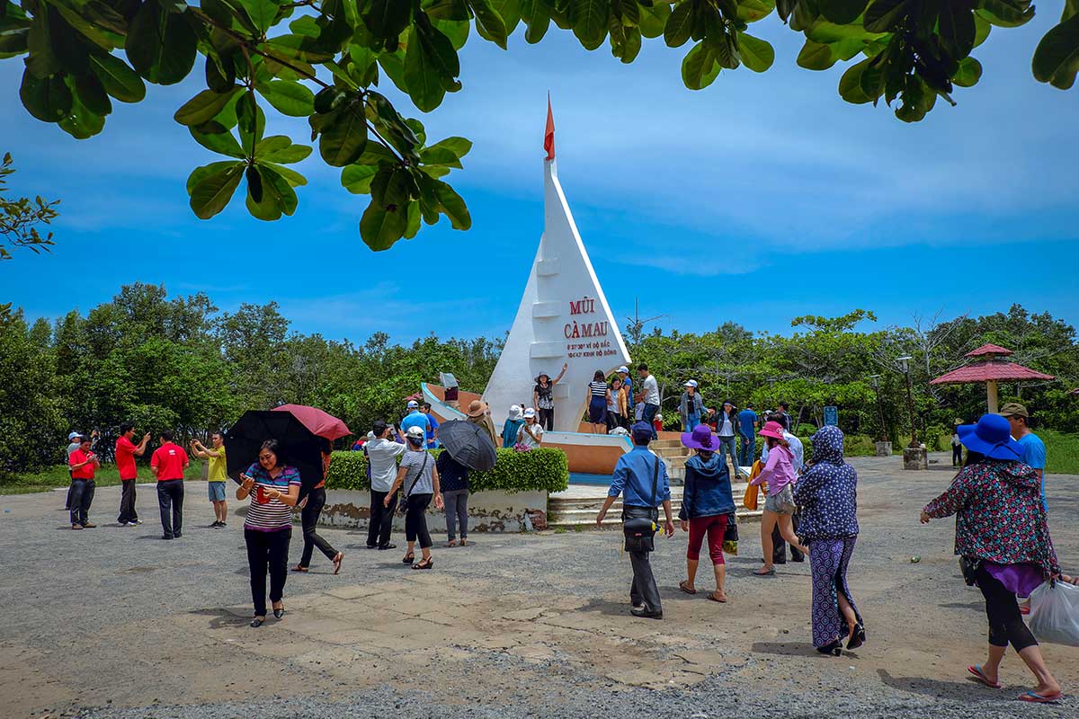
National Coordinate GPS 0001 – the most photographed marker, a six-pointed star set on a pedestal that officially identifies Vietnam’s southernmost point. Many travelers come here mainly to “check in” with a photo.\
Ho Chi Minh Road endpoint marker – a symbolic monument marking where the country’s most famous road is said to finish at the edge of the land, tying the cape to the nation’s history of reunification.
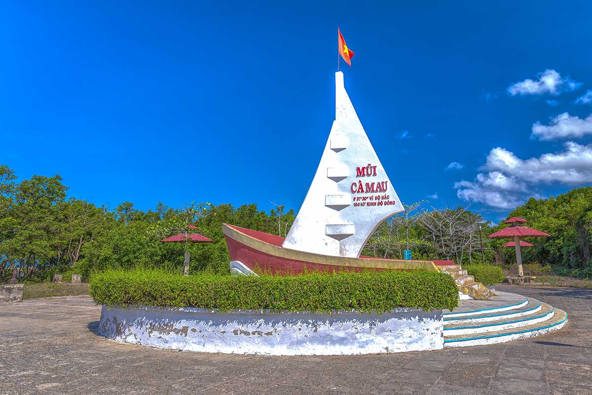
Ship-shaped monument – a concrete structure built in the form of a ship pointing out to sea, representing Vietnam’s resilience and seafaring spirit.
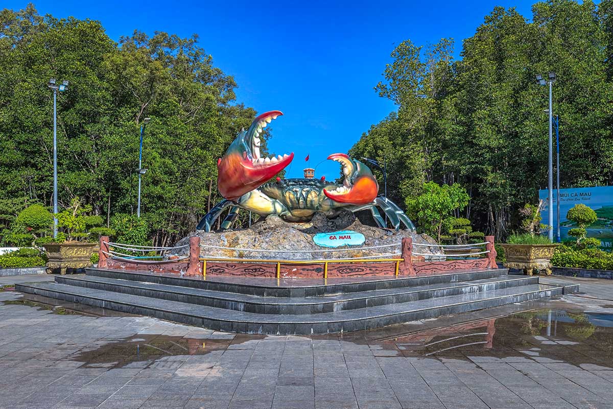
Ca Mau Crab Sculpture – a large statue of the province’s best-known specialty, the blue crab, which is both a local pride and a quirky photo stop.
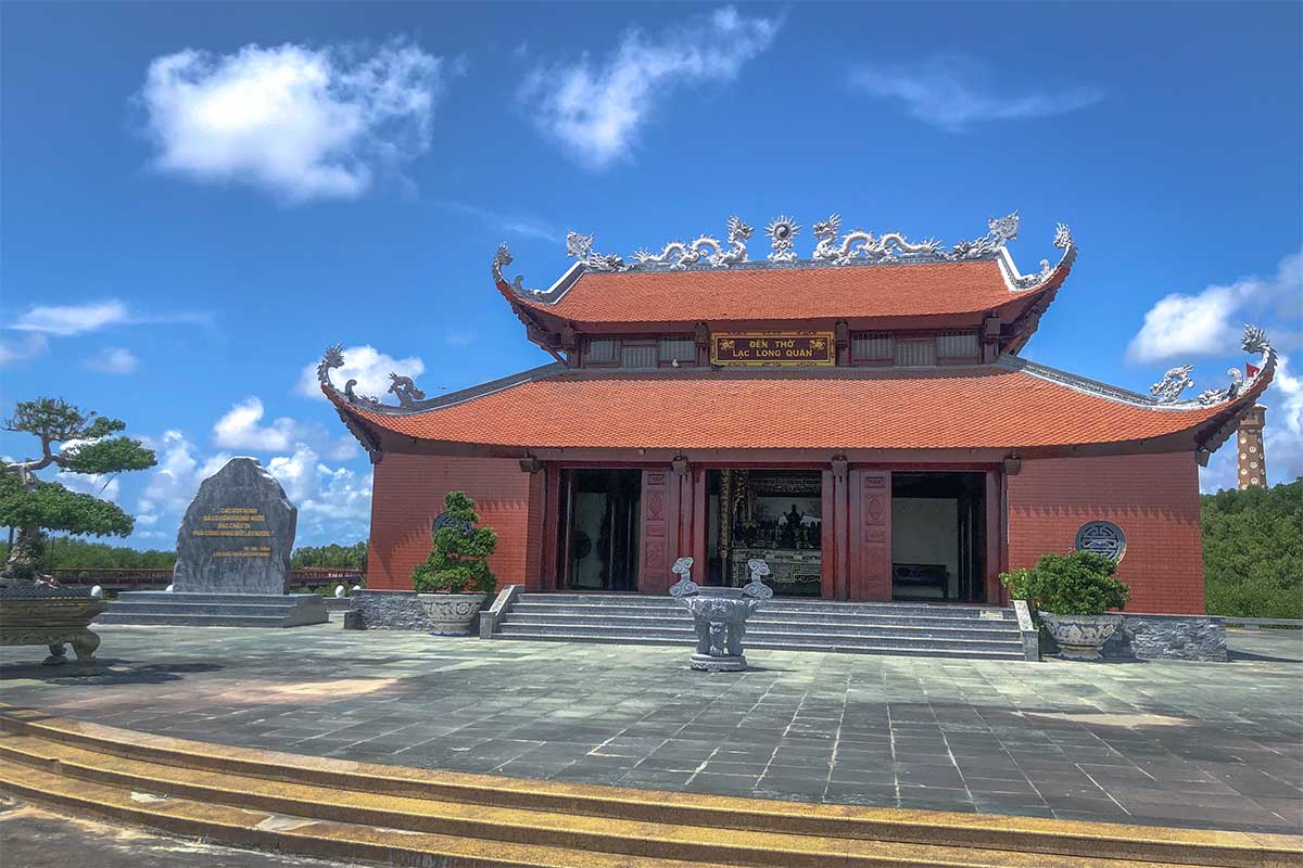
Lac Long Quan Temple – a small temple dedicated to Lac Long Quan, the legendary father of the Vietnamese people, built to reinforce cultural identity at the country’s southern tip.
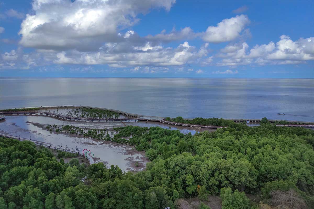
5. Sunrise & sunset views
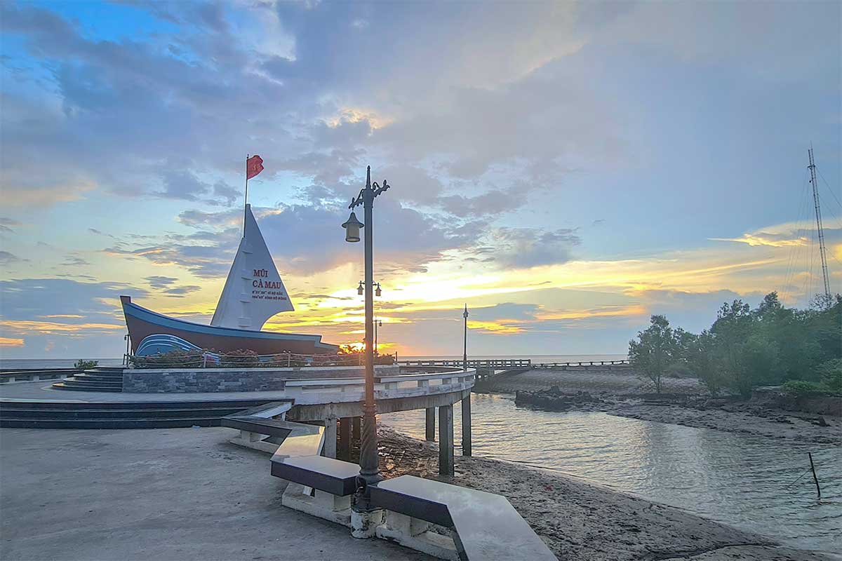
Ca Mau Cape is one of the rare places in Vietnam where you can see both sunrise and sunset over the sea. In the morning the sun rises over the East Sea, and in the evening it sets into the Gulf of Thailand. The best views are from the breakwaters and embankments that stretch out into the water.
6. Local life & fishing culture
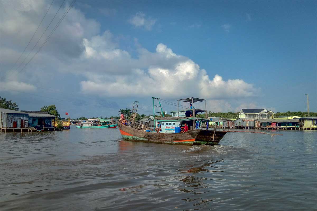
Life around Dat Mui village is still closely tied to the sea and mangroves. Shrimp ponds and small fishing boats line the canals, and one unique tradition is the “houses without doors” in Xom Mui hamlet — a cultural quirk reflecting the openness of the community. Some small homestays allow visitors to join family meals, experience rural hospitality, and get a sense of daily life at the cape.
7. Food & specialties
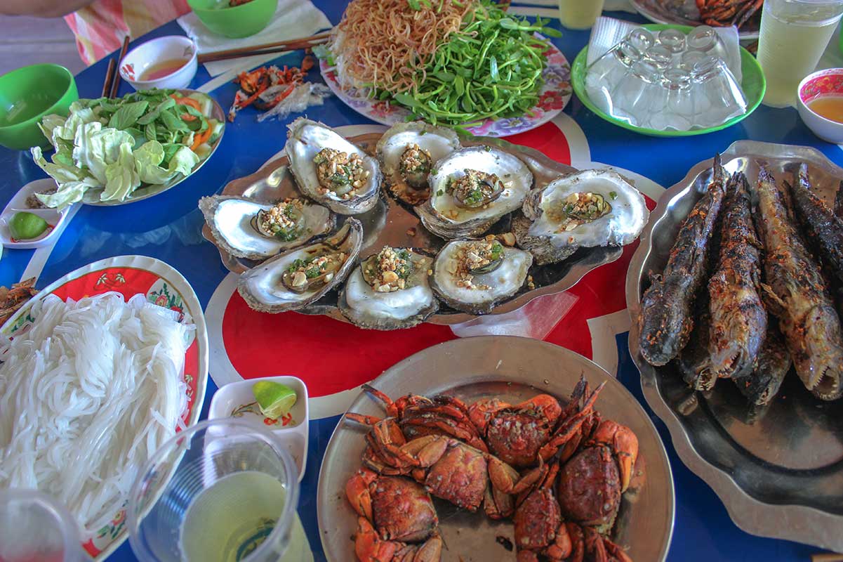
Seafood is the highlight of any trip to Ca Mau Cape. The region is most famous for Ca Mau crab, considered among the best in Vietnam for its sweet, rich meat. Other specialties include grilled or braised mudskipper, fresh oysters, snail dishes, and local fish sauce. Meals are often simple but fresh, with ingredients coming straight from the surrounding waters.
How to get to Ca Mau Cape
Getting to Ca Mau City (the base)
Ca Mau City is the main base for trips to the cape. From Ho Chi Minh City, the most common option is an overnight bus with companies like Phuong Trang or Giap Diep, which takes around 8–9 hours. If you prefer speed, Vietnam Airlines operates a short flight from Ho Chi Minh City in about one hour. From Can Tho, the journey by road is shorter and takes around 4–5 hours.
From Ca Mau City to Ca Mau Cape
The cape lies about 100 km south of Ca Mau City.
- By road – The drive takes 2–3 hours, but be prepared for rough stretches with many potholes.
- By bus – Local buses run to Dat Mui village, from where you can continue by taxi or motorbike taxi to the park entrance.
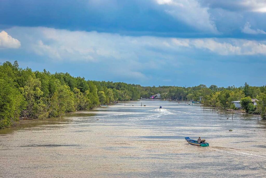
- By waterway – Another option is taking a boat or canoe from Nam Can, which winds through the mangroves and takes about 2.5–3 hours. This is more scenic but less convenient.
- By motorbike – Adventurous travelers can ride down themselves, though the long ride and bumpy road can be tiring.
- By private car/driver – The most practical choice, offering comfort and flexibility, especially in such a remote area.
Practical information & Tips for Visiting
Opening times
The park is open daily from dawn to dusk.
Entrance fees
Tickets cost around 30,000 VND per person. There is an additional fee of about 60,000 VND if you want to use the electric carts that shuttle visitors around the developed area.
Best time to visit
The dry season (December–April) offers the most comfortable conditions, with clearer skies and easier access by road. During the rainy season (May–November), roads can be muddy and slow, but the mangroves look greener and more alive.
What to bring
- Mosquito repellent – essential, especially around dusk.
- Sun protection – hat, sunglasses, sunscreen.
- Cash – for entrance fees, boat rides, and local food (cards are not accepted).
- Water & snacks – limited options inside.
- Translation app – English is not widely spoken.
Other sights in Ca Mau Province
If you are already making the long journey to Ca Mau, it’s worth combining the cape with other destinations in the province:
- U Minh Ha National Park – flooded forest, rich wildlife, and local honey traditions.
- Ngoc Hien Bird Sanctuary – seasonal birdwatching opportunities.
- Thi Tuong Lagoon – vast inland lagoon with stilt houses and fishing culture.
- Hon Da Bac Island – rocky island with viewpoints and small pagodas.
- Khai Long Beach – one of the few sandy beaches in the area.
For details, see our full guide to things to do in Ca Mau.
Is Mui Ca Mau National Park worth visiting?
For many Vietnamese, Ca Mau Cape is a meaningful place to visit at least once in their lifetime — standing at the country’s southernmost point carries strong symbolic value. For foreign travelers, the appeal lies more in the mangrove ecosystem and the novelty of reaching “the end of the land.”
That said, the developed area with its monuments and replicas often feels overbuilt and can be underwhelming if you expect untouched wilderness. The park is best appreciated when combined with other experiences in Ca Mau Province such as boat rides, Thi Tuong Lagoon, U Minh Ha forest, or bird sanctuaries.
On its own, Mui Ca Mau National Park is not always worth the long detour from Ho Chi Minh City. But as part of a broader trip through the Mekong Delta’s remote southern edge, it offers a mix of nature, culture, and symbolism that you won’t find anywhere else in Vietnam.