
What is Ca Pass Like
Location and Scenery
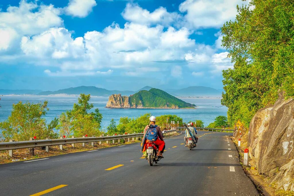
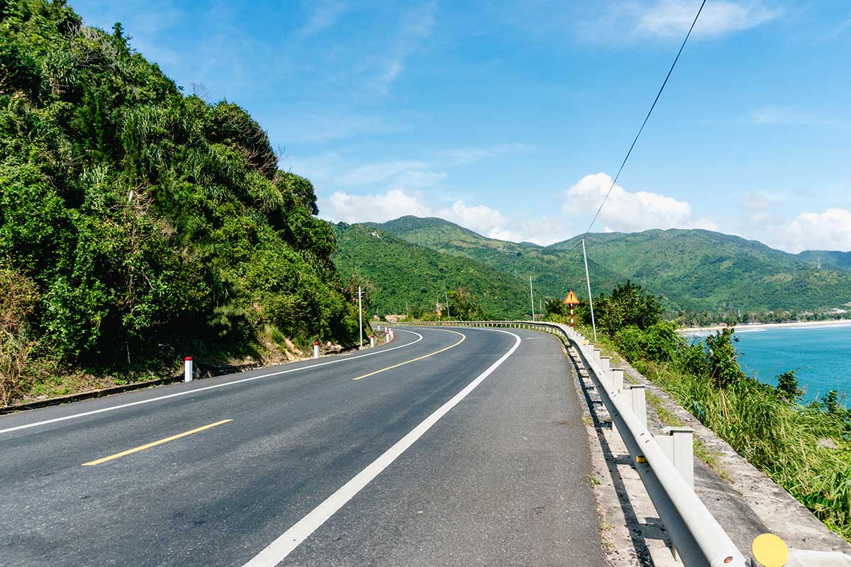
Ca Pass stretches for about 12 km along the border of Phu Yen and Khanh Hoa, climbing to an elevation of roughly 330 meters. The road winds between steep granite cliffs, forested slopes, and the open sea, making it one of the most dramatic stretches of coastal highway in central Vietnam.
On a clear day, you can look north toward Vung Ro Bay with its fishing boats and floating farms, or south to the long curve of Dai Lanh Beach. The combination of sea views on one side and mountains on the other is what makes the pass so memorable.
History of the Pass
Ca Pass is one of Vietnam’s “four great passes,” natural gateways that once divided different regions and cultures along the coast. Its location made it a frontier for centuries: battles were fought here between the Champa and Dai Viet kingdoms in the 15th century, later between the Tay Son and Nguyen Anh as he pushed to unify Vietnam, and again during the French colonial period and the American war. Because of this strategic importance, the pass is not only scenic but also historically significant.
Tunnel and Development
For most of its history, Ca Pass was a challenging and dangerous section of Highway 1, clogged with trucks and buses inching around blind curves. That changed with the opening of the Deo Ca Tunnel in 2017, a 4.1 km engineering project that became Vietnam’s second-longest road tunnel.
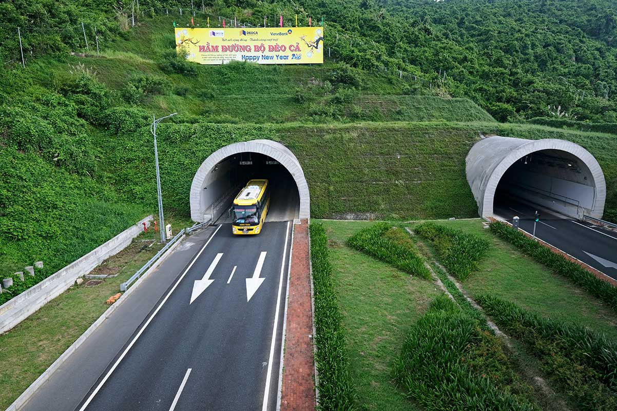
Today the tunnel carries almost all heavy traffic, cutting travel time by nearly an hour and making the old road far quieter. For travelers this is a blessing: the pass is now much safer to drive, especially by motorbike, though motorbikes are not permitted in the tunnel and must still take the old road. In stormy or typhoon season, the tunnel also provides a more reliable option, while the pass itself is best enjoyed in good weather.
The Pass (QL1A) vs Coastal Road (QL29)
There are actually two different ways to experience Ca Pass, and knowing the difference helps you plan your drive.
The main pass road is QL1A, Vietnam’s National Highway 1. This is the true mountain pass: a winding 12 km stretch of curves and climbs that cuts between granite cliffs and the sea. Here you’ll find the classic highlights like roadside viewpoints, the trailhead to Da Bia Mountain, Black Rock Curve, and the railway hugging the cliffs.
The coastal detour is QL29, a spur road that drops down to the bays east of the pass. This route takes you to Bai Mon Beach, Mui Dien Cape, the Dai Lanh Lighthouse, and Vung Ro Bay with its fishing villages, war memorial, and floating seafood restaurants.
Both routes eventually rejoin at Dai Lanh Beach on the southern side. If you have time, you can combine them into a loop — drive one way over the mountain and the other along the coast. Done this way, Ca Pass can easily become a rewarding half- or full-day trip rather than just a quick crossing.
Highlights of driving the Ca Pass (QL1A)
Before diving into the individual stops, it’s worth setting expectations. The pass itself is not packed with attractions every few hundred meters — the main reward is the drive and the scenery. If you’re just looking to tick it off, you could cross it in 30–45 minutes. But if you stop at viewpoints, take the hike up Da Bia, or pause for photos, you can easily spend a couple of hours here.
1. Scenic viewpoints and Roadside cafés
Along the curves of the pass are a handful of informal pull-offs where you can stop for photos of the sea and mountains. Some locals have set up hammock cafés in simple shacks, serving coconuts or iced coffee with a view. These are basic but make for a relaxed stop, especially in the cooler morning or late afternoon light.
2. Start of hike to Da Bia Mountain
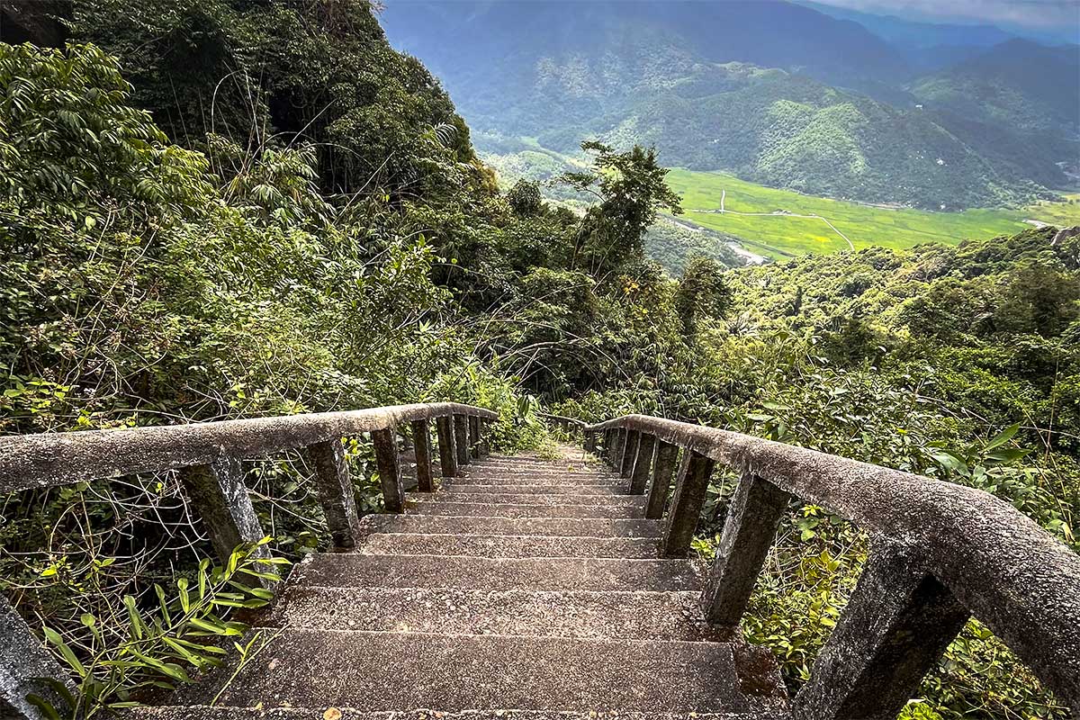
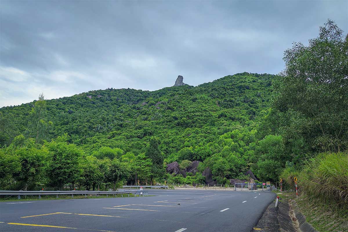
Halfway up the northern slope is the trailhead to Da Bia Mountain, marked by a small café and parking area. The hike is steep but straightforward, about 2.2 km of stone steps leading up to the summit.
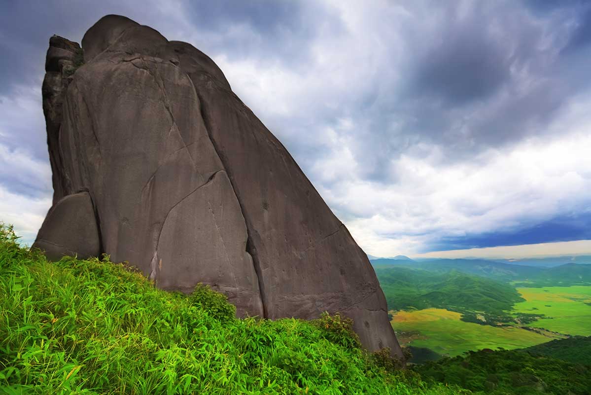
Allow 2–3 hours for the round trip. At the top stands the famous Da Bia Rock, a towering granite pillar visible from the pass below, and the views stretch across Phu Yen’s coastline and inland valleys.
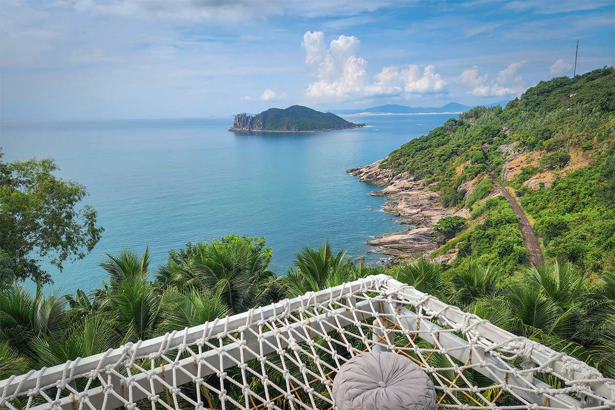
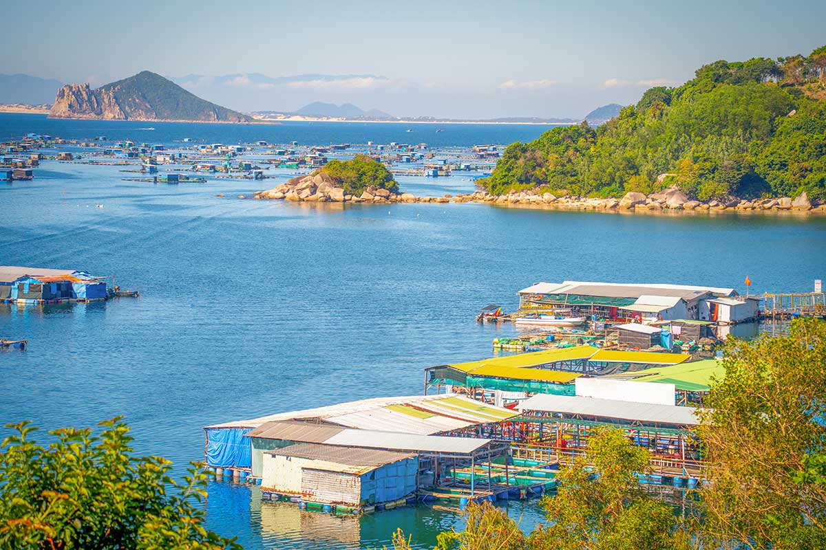
3. Vung Ro Bay (Views from the Pass)
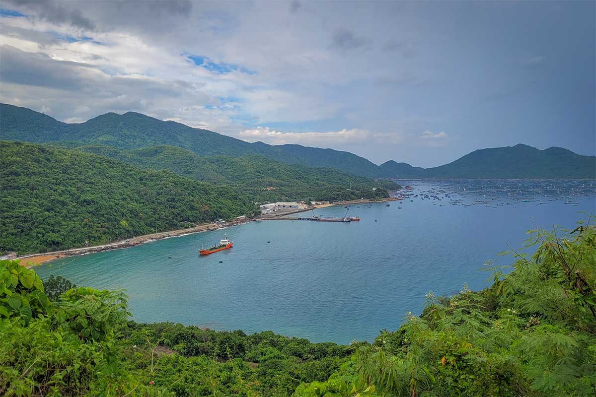
From several points on the road you can look down into Vung Ro Bay, a sheltered harbor dotted with fishing boats and floating houses. It’s a beautiful sight from above, even if you don’t take the detour down on QL29.
4. Railway views
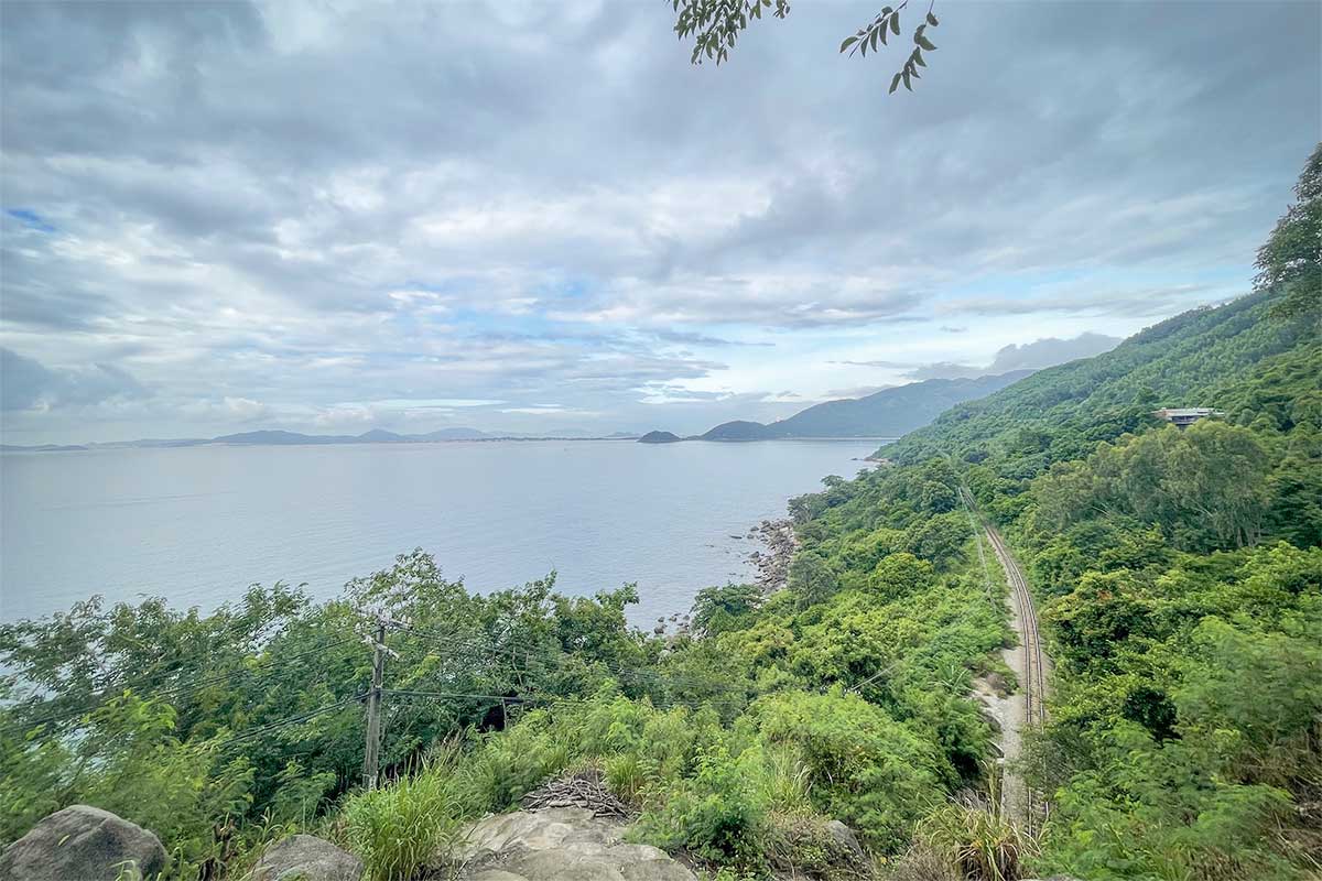
On the southern slope, the North–South railway line clings to the cliffs just above the water. If you’re lucky, you may spot a train winding its way along this dramatic section of track. Even without a train, the sight of the rails beside the sea is one of the pass’s more photogenic details.
5. Black Rock Curve (Cua Da Den)
At the provincial border between Phu Yen and Khanh Hoa, the road cuts through a massive granite outcrop known as Cua Da Den, or Black Rock Curve. The overhanging boulder above the highway is a striking feature and makes it clear why carving a road through this terrain was such a challenge.
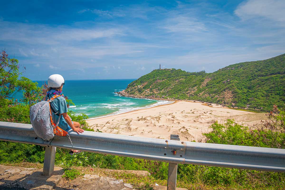
6. Dai Lanh Beach
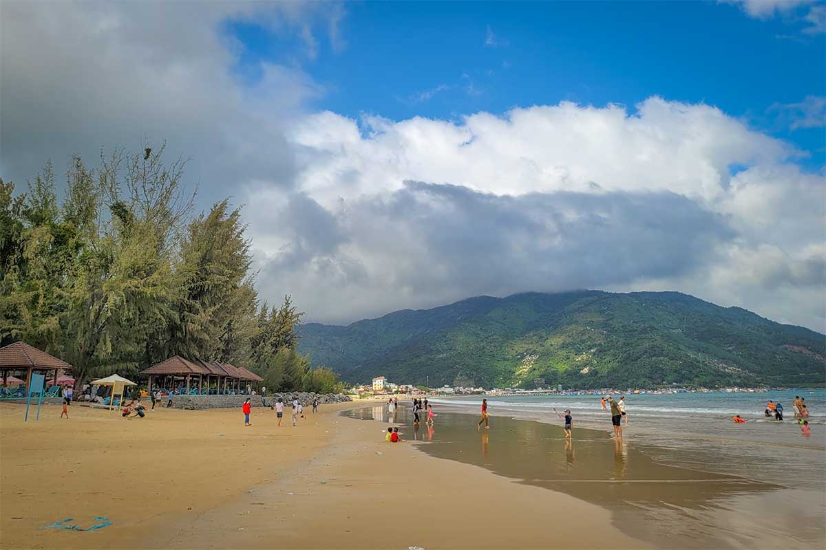
At the southern foot of the pass lies Dai Lanh Beach, a long stretch of white sand backed by a small fishing village. It’s not a polished resort beach, but it makes a natural endpoint to the drive, and you’ll often see fishing boats pulled onto the sand. If you’re heading south, this is where the pass experience ends and the road flattens out again toward Nha Trang.
Highlights of driving the coastal route (QL29)
Taking the coastal detour off QL1A brings you down to the bays and beaches east of the mountains. The road itself is a highlight, hugging the shoreline with wide views of the sea, but there are also several stops worth making along the way.
1. Bai Mon Beach
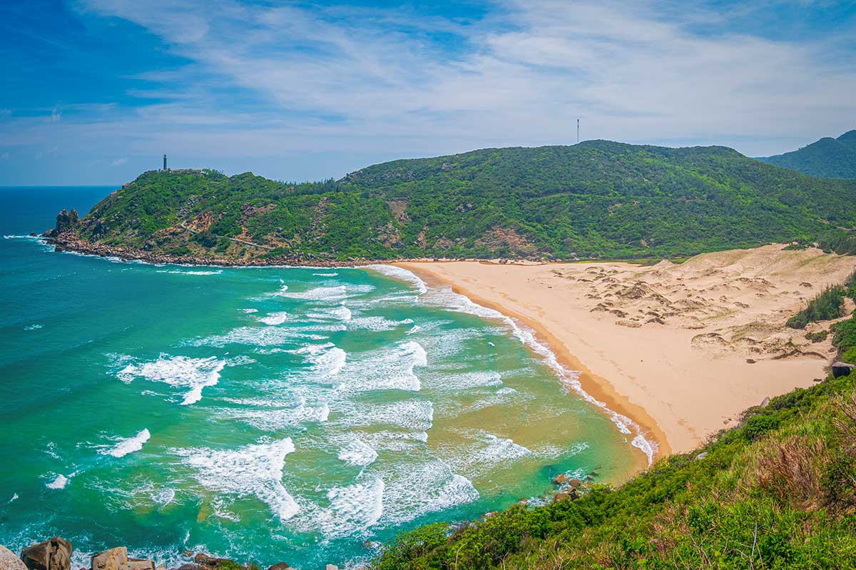
Bai Mon is a crescent-shaped beach sitting just below Mui Dien Cape. It looks stunning from above, especially in early morning light. To access it you’ll pay a small entrance fee (around 20,000 VND) and extra for parking. Unfortunately, swimming is not allowed and visitors often complain about litter on the sand, so it’s best treated as a photo stop rather than a place to relax for hours.
2. Dai Lanh Lighthouse (Hai Dang Dai Lanh)
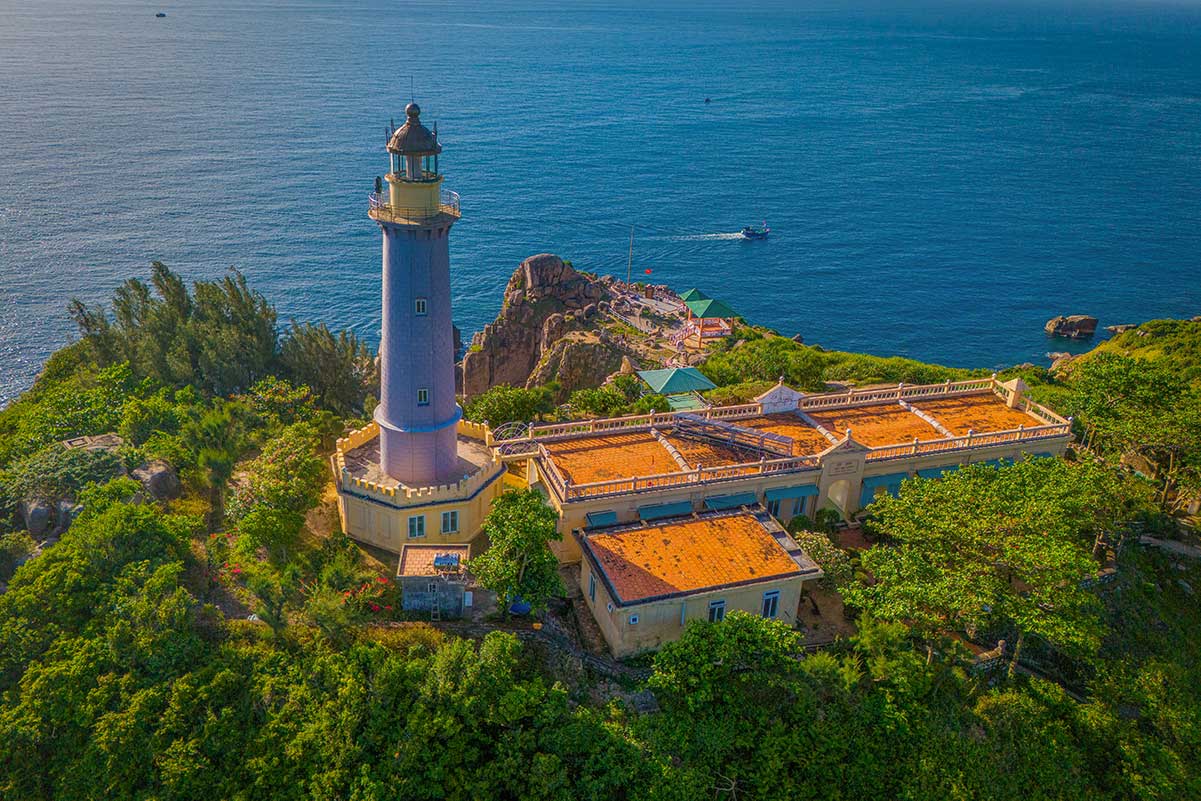
Perched on the cape above Bai Mon, the lighthouse is one of the big draws of this route. To reach it, you’ll either hike 15–20 minutes uphill from the parking area or take a short motorbike taxi ride. Entry costs about 20,000–30,000 VND plus a small parking fee. The lighthouse itself is modest, but the views over the cliffs and sea are spectacular. Many travelers come here at dawn to catch one of Vietnam’s earliest sunrises.
3. Mui Dien Cape (Easternmost Point)
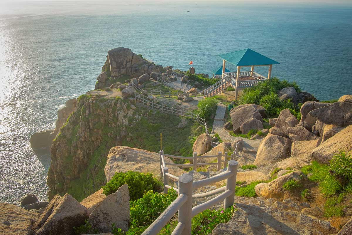
Just beyond the lighthouse is Mui Dien Cape, often promoted as the easternmost point of mainland Vietnam. Whether or not that’s technically true, it feels like a special spot — standing at the edge of the cliffs, watching the sun rise over the sea, with Bai Mon Beach below and nothing but open water to the horizon.
4. Vung Ro War Memorial
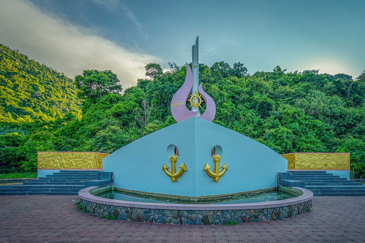
Further along QL29 you’ll find the Vung Ro War Memorial, a simple but meaningful site that commemorates the wartime supply landings along the so-called Ho Chi Minh sea trail. There’s a large parking area, a small exhibition hall, and good views over the bay. It won’t take long to visit, but it adds a layer of history to the trip.
5. Vung Ro Bay
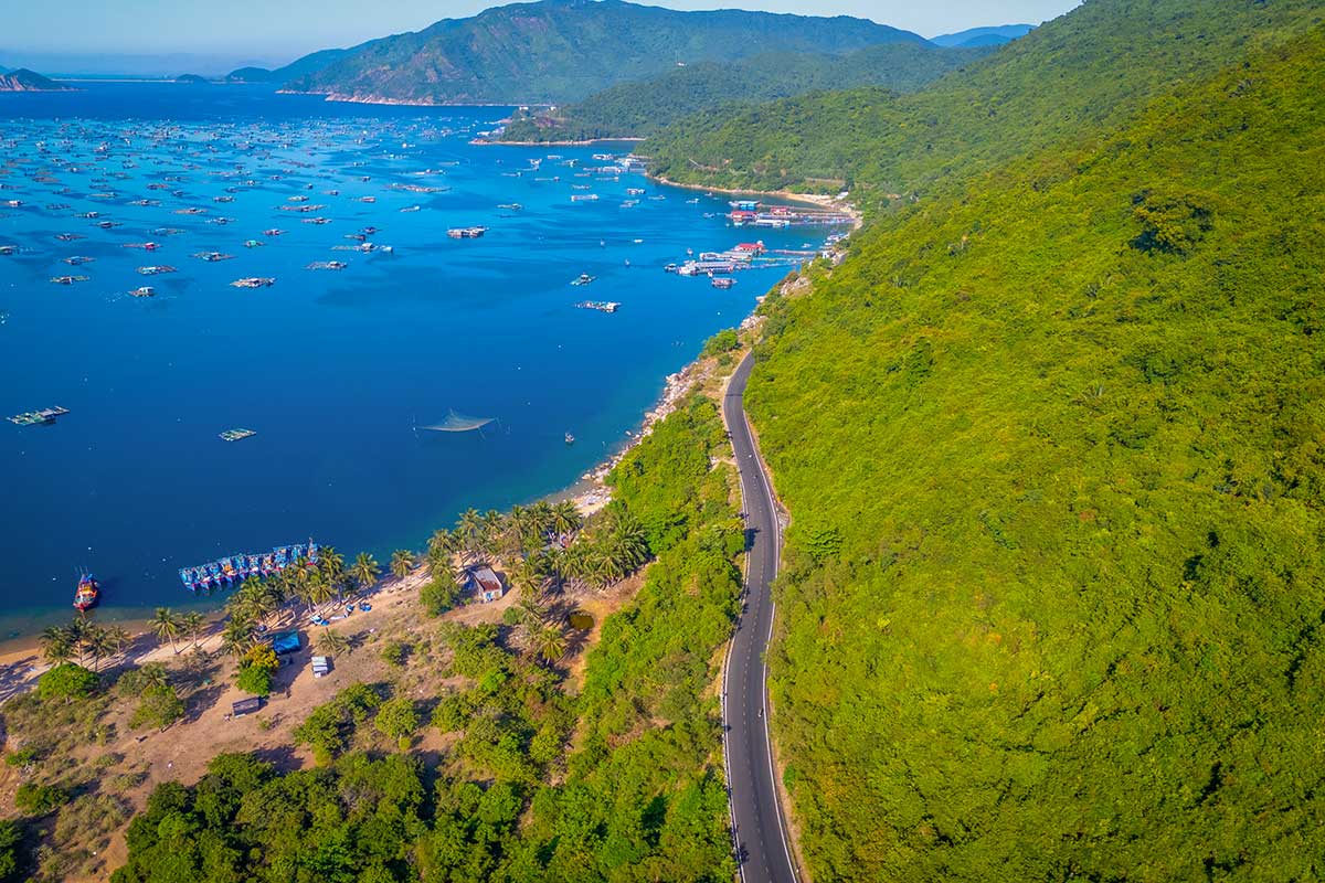
Vung Ro Bay itself is one of the prettiest natural harbors in this part of Vietnam. Surrounded by forested hills and dotted with fishing boats, it offers a striking contrast of sea, mountains, and floating houses. You can stop at viewpoints along the road or head down to the shore, where boat trips are available.
6. Vung Ro Fishing Village & Floating restaurants
On the water, floating restaurants serve fresh seafood at simple tables. You’ll usually board a small boat from the shore to reach them. Prices are reasonable, the setting is relaxed, and it feels like a genuine local experience rather than a polished tourist attraction.
7. Where the coastal road and Ca Pass meet
After the detour along QL29, the road merges back with QL1A at the northern slopes of Ca Pass. From this point southwards, the two routes share the same highlights:
- Railway Views – short stretches where you can glimpse the coastal railway line running along the cliffs.
- Black Rock Curve (Cua Da Den) – the dramatic granite overhang cut through the mountain, marking the provincial border.
- Dai Lanh Beach – a long, sandy beach at the southern foot of the pass, a natural endpoint for the journey.
Practical tips for driving the Ca Pass
Where to Start and End
Most people begin from Tuy Hoa (about 20 km north of the pass) or Nha Trang (around 80 km south). Tuy Hoa is the easier base if you want a short trip with time to explore the coastal detour. At the southern end, Dai Lanh Beach makes a natural stop, with a few simple guesthouses if you want to overnight.
Motorbike or Car?
A motorbike gives you the most rewarding experience — the open curves, fresh air, and freedom to stop at viewpoints. But the road is steep and twisting, so it’s really only for confident riders. Officially, you need a motorbike license plus an International Driving Permit (IDP). In reality, police checks and rental shop requirements are rare, but if you have an accident without the right license, your insurance might not cover you.
A car is safer and more comfortable, especially if you prefer to enjoy the views without worrying about sharp bends. You’ll miss some of the thrill, but it’s still a beautiful drive.
Renting a Motorbike
For mountain roads, a semi-automatic or manual motorbike is much better than a scooter with automatic transmission, which can struggle on steep climbs and be harder to control on descents. Expect rental costs between 150,000–250,000 VND per day. You can arrange rentals easily in Tuy Hoa or Nha Trang.
Road conditions & Traffic
The pass road is paved and generally in good condition, but it has sharp bends, blind corners, and occasional small rockfalls. Heavy trucks and buses now use the tunnel, so the pass itself is usually quiet and safe for sightseeing.
Weather and Best time to visit
The dry season (January–August) offers the clearest skies and safest conditions. In the rainy season (September–December), fog and slippery curves make the road more difficult, and it’s best avoided during storms or typhoons.
Because the pass is exposed, it can feel very hot at midday, so bring sun protection if riding a motorbike. There’s only a moderate climb (up to ~330 m), so temperatures aren’t dramatically cooler, but the breeze can make it more comfortable. Avoid driving after dark — sharp bends and limited lighting make it unsafe.
Time Needed
- Driving the pass itself: 30–45 minutes.
- Adding the QL29 coastal detour: half a day to a full day, depending on how many stops you make.
Facilities along the road
There are no fuel stations on the pass, so fill up in Tuy Hoa or Dai Lanh before starting. You’ll find a few small roadside cafés on the pass, and local seafood restaurants at Vung Ro Bay and Dai Lanh. Vung Ro is also known for its floating seafood restaurants, a unique place to stop for lunch.
Is Ca Pass worth visiting?
Ca Pass is absolutely worth it if you enjoy road trips, big scenery, and a sense of adventure. The drive gives you sweeping views of mountains dropping into the sea, quiet curves to ride without heavy traffic, and detours that take you to sunrise viewpoints and fresh seafood stops around Vung Ro Bay.
It’s less rewarding if you expect pristine beaches or polished facilities — places like Bai Mon often disappoint with fees, litter, or swimming bans. Think of the area more as a scenic drive and cultural detour than a beach holiday spot.
Compared with the more famous Hai Van Pass, Ca Pass is shorter and less dramatic in scale, but it feels quieter, more under-the-radar, and in some ways more authentic. If you’re already exploring Phu Yen or driving the south-central coast, it’s a highlight worth adding to your route.