
Flooding in Vietnam through history and myth
Floods in Vietnam’s History
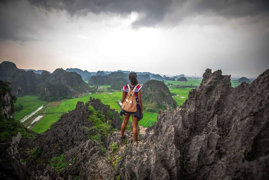
Flooding in Vietnam is not just a modern issue — it has shaped the country’s geography, agriculture, and way of life for centuries. The Red River Delta in the north and the Mekong Delta in the south have long been prone to seasonal flooding due to their low-lying terrain and proximity to major rivers. These fertile but flood-prone regions have historically faced both the benefits and the dangers of high water.
To manage this, the Vietnamese developed early flood-control systems such as dykes, canals, and sluice gates. These systems date back over a thousand years, especially around Hanoi, where complex embankments were built to protect farmland and cities. Even today, many rural areas rely on updated versions of these traditional methods to regulate the flow of water during the rainy season.
The Myth of Son Tinh and Thủy Tinh
One of Vietnam’s most enduring myths explains flooding not as a random natural disaster, but as the result of an ancient rivalry between elemental forces. In the legend, Sơn Tinh (the Mountain God) and Thủy Tinh (the Water God) both sought to marry a beautiful princess. When Sơn Tinh won her hand by arriving first with rare wedding gifts, Thủy Tinh was furious and unleashed massive storms and floods to reclaim her.
Each year, Thủy Tinh returns in anger, sending rain and rising waters to challenge the land — but Sơn Tinh responds by raising the mountains even higher. The story is often told to children and remains a cultural reference point, especially during typhoon season. Rather than evoking fear, the myth reflects how Vietnamese people view flooding: not as something to panic over, but as a yearly struggle that can be met with strength, preparation, and resilience.
When is flooding most likely in Vietnam?
Flooding in Vietnam is closely tied to the country’s rainy season and the annual typhoon cycle. Most floods are caused by prolonged rainfall, sudden downpours, or rising river levels — and while heavy rain doesn’t always lead to flooding, it significantly increases the chance, especially in low-lying or poorly drained areas. If you’re unfamiliar with the seasonal weather across regions, see our complete guide to the rainy season in Vietnam for a month-by-month breakdown.
North Vietnam
The rainy season in northern Vietnam typically runs from May to September, with the most intense rainfall in July and August. Flooding tends to affect rural and mountainous areas more than major cities — places like Ha Giang, Lao Cai, and parts of Thanh Hoa can experience flash floods or landslides when the soil becomes saturated.
In Hanoi, the main issue is urban flooding. During heavy storms, the city’s outdated drainage system can’t keep up, causing water to pool on streets for several hours. While rarely dangerous, this kind of flooding can delay travel or soak unwary pedestrians, especially in older districts.
Central Vietnam
Central Vietnam has a later rainy season, stretching from September to December, with peak flooding usually in October and November. This period overlaps with Vietnam’s typhoon season, when tropical storms from the East Sea (South China Sea) bring large volumes of rain to the central coast.
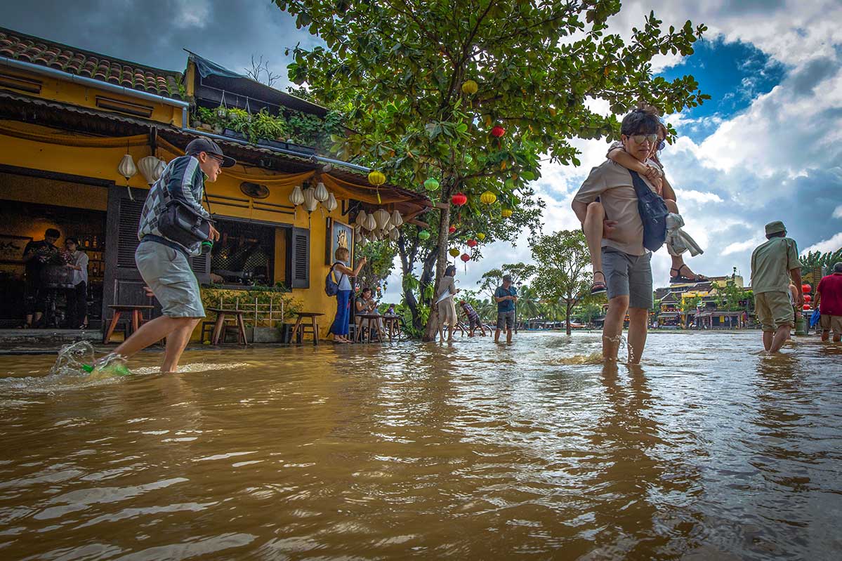
Historic towns like Hoi An and Hue, as well as larger cities like Da Nang, often experience river floods caused by water flowing down from the highlands. These floods can submerge streets or parts of the old town for several days, but locals are well prepared — boats, raised platforms, and temporary barriers are part of normal life during this season.
South Vietnam
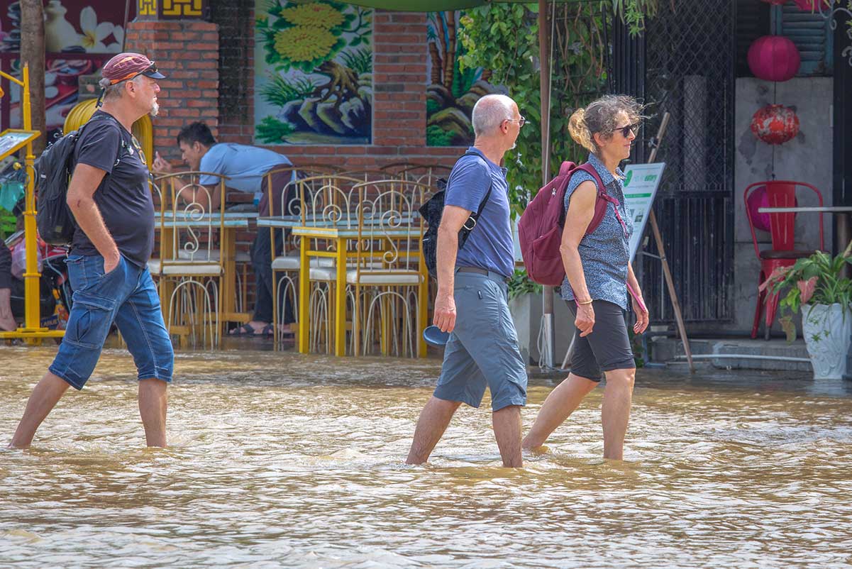
Southern Vietnam’s rainy season runs from May to November, with a mix of short, daily downpours and longer periods of rain. The most flood-prone areas are Ho Chi Minh City, where street-level flooding is common after even moderate rain, and the Mekong Delta, where seasonal river flooding causes water levels to rise across fields, canals, and roads.
Unlike the central region, flooding here is often shallow and predictable, part of the so-called “floating season.” In most cases, it’s not a disruption but a seasonal change that locals work around — and sometimes even celebrate.
Areas most affected by flooding
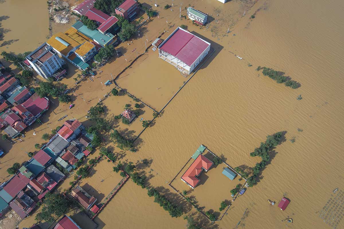
Floods can happen anywhere in Vietnam, but some regions are more vulnerable than others due to their geography, river systems, and urban infrastructure. Low-lying deltas, riverside towns, and mountainous areas all face different types of flood risks — from calm seasonal overflows to sudden flash floods. Understanding where these risks are highest can help you plan smarter, especially during the rainy season.
Hanoi & Ho Chi Minh City
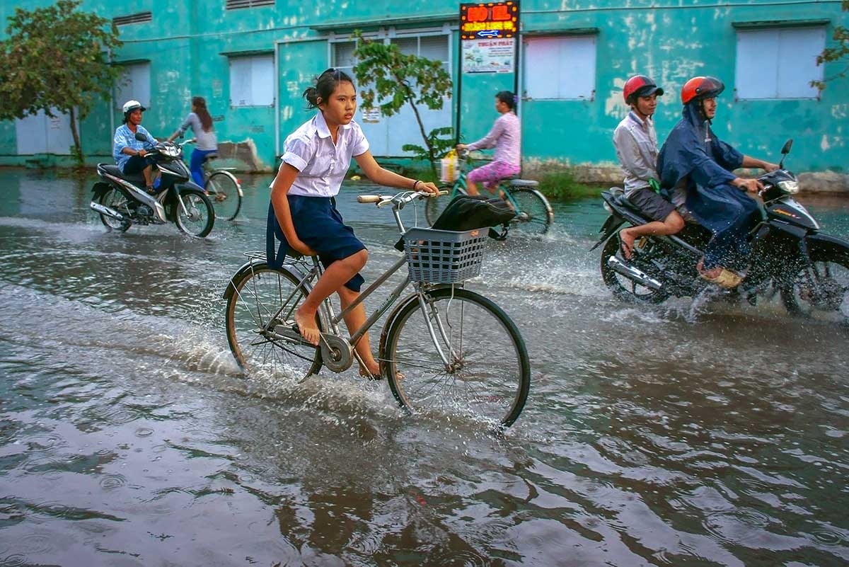
In both Hanoi and Ho Chi Minh City, the main issue is urban flash flooding. These occur when heavy rain overwhelms drainage systems, leading to ankle- or knee-deep water pooling on major streets. It usually clears within a few hours, but can make walking or driving tricky.
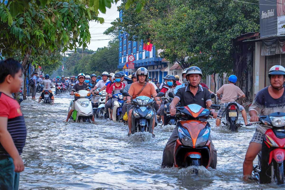
In HCMC, flooding is especially common in District 2, District 7, and parts of Thu Duc City, where development has outpaced drainage upgrades. In Hanoi, flash floods are most noticeable in older neighborhoods such as the Old Quarter and low-lying streets around Dong Da and Thanh Xuan. While infrastructure is gradually improving, even short cloudbursts can still cause temporary street floodin
Central Vietnam (Hue, Hoi An, Quang Nam, Quang Binh, Da Nang)
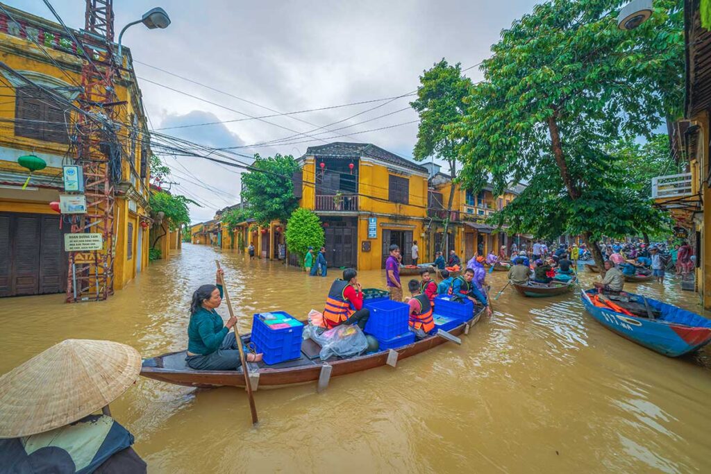
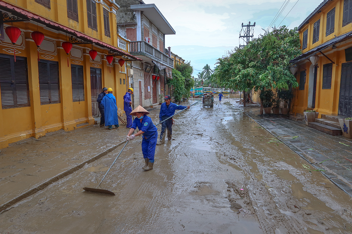
Central Vietnam experiences some of the most serious seasonal floods, particularly from October to November when rivers rise due to upstream rain and typhoons. The Thu Bon River in Hoi An and the Perfume River in Hue often overflow, sometimes turning streets into shallow canals.
In Hoi An, it’s not uncommon for parts of the old town to be underwater for a few days during peak season. These floods are predictable and rarely dangerous, and locals handle them with remarkable calm — using boats, raised walkways, and waterproofing to carry on with daily life. Some visitors even find it a beautiful experience, with lanterns reflecting off floodwaters and cafés operating from second floors.
Mountainous Regions (Northern Highlands, Central Highlands)
In the highlands, flooding takes a different form. Areas like Sapa, Ha Giang, Dalat, and sections of the Ho Chi Minh Road are more prone to flash floods and landslides, especially after long stretches of heavy rain.
These events can temporarily block mountain passes or damage smaller roads in rural areas. While tourist hubs are generally safe, travelers venturing into remote villages or doing motorbike loops should be aware of possible delays, reroutes, or road washouts — especially in the wettest months. Local authorities usually respond quickly, but it’s worth checking road conditions during stormy periods.
Mekong Delta
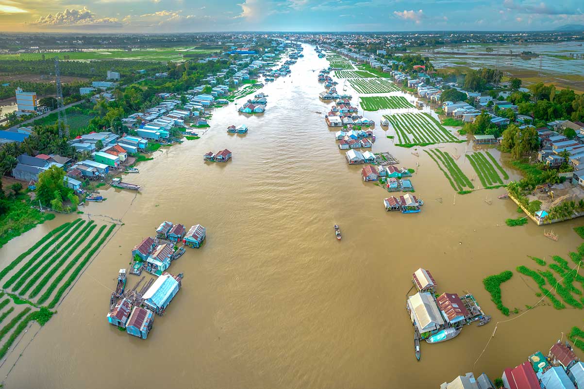
Flooding in the Mekong Delta is part of the natural rhythm of life. Each year, from late August to October, water levels rise across rivers and fields in what’s locally known as the “mùa nước nổi” — or the “floating season.”
Rather than causing chaos, this seasonal flooding supports agriculture, fisheries, and even local tourism. Villages adapt by raising houses, shifting transport to boats, and building floating markets. Floodwaters are generally calm and slow-moving, creating scenic rural landscapes rather than dangerous conditions. It’s one of the few places where flooding feels more like a lifestyle than a crisis.
Landslides and Mountain hazards after heavy rain
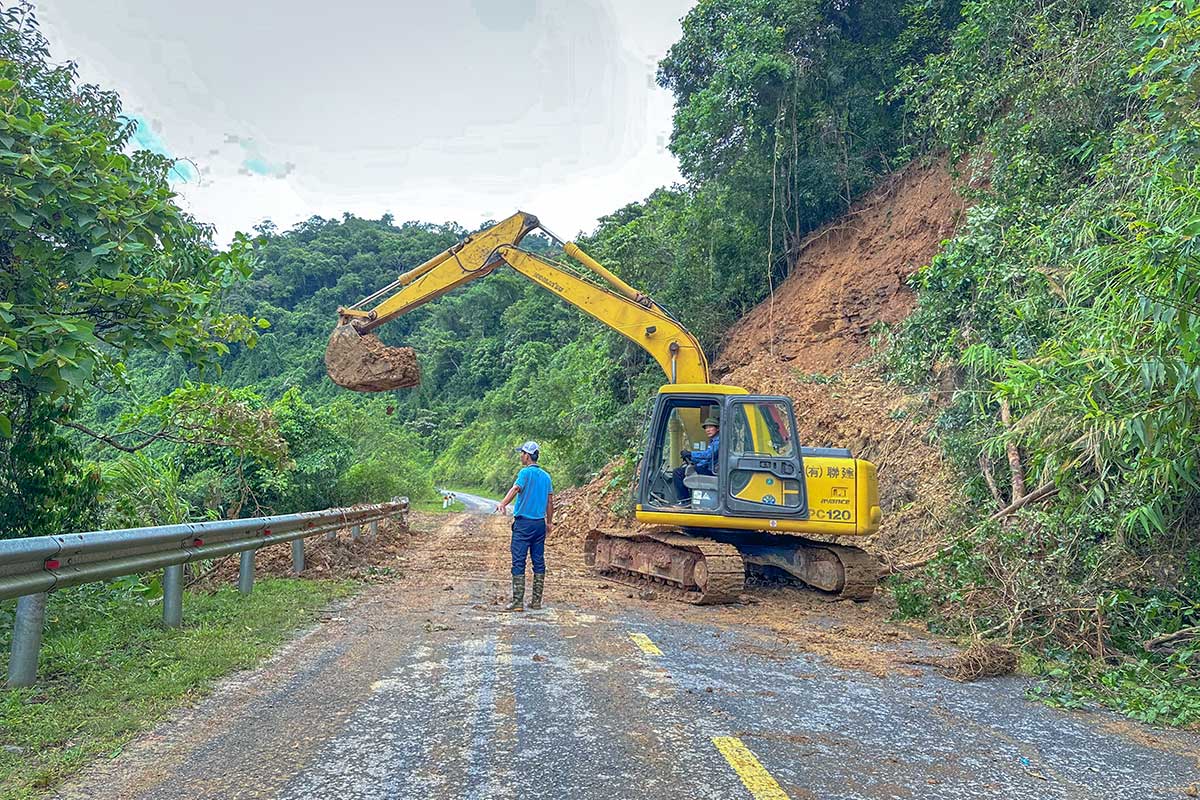
While lowland flooding gets more attention, landslides are a serious risk in Vietnam’s mountainous regions — especially after prolonged or intense rainfall. Steep terrain, soft soil, and increasing deforestation all contribute to unstable slopes, particularly where roads have been cut into hillsides without strong reinforcement.
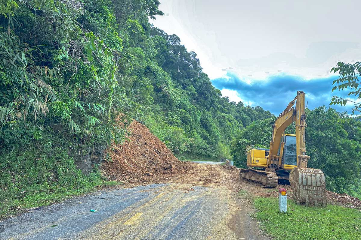
The risk is highest in northern Vietnam, along routes like the Ha Giang Loop, Sapa’s trekking trails, and parts of the Hoang Su Phi or Dien Bien region. In the Central Highlands, areas around Dalat, Kon Tum, and Pleiku may also see occasional road blockages or slope collapses. Landslides tend to follow patterns: they’re most likely in the days after heavy storms, not during light daily rain.
For travelers, this doesn’t mean avoiding these regions — it just means staying informed. If you’re planning a motorbike trip or trekking after several days of rain, check local advice or ask your accommodation about road and trail conditions. Vietnam is quick to respond: in most cases, landslide-affected roads are cleared within a day or two.
How Vietnam handles flooding: Local resilience
Flooding in Vietnam isn’t treated as an emergency every time it happens — it’s a recurring part of life, especially in the rainy season. While some years bring more severe storms than others, most floods are local, short-lived, and handled with calm efficiency. For many communities, especially in flood-prone areas, the response has become second nature.
Vietnam has long invested in infrastructure designed to manage water, from ancient dyke systems around Hanoi to modern drainage networks in cities like Ho Chi Minh City. In central Vietnam, flood warnings are often issued days in advance, giving locals time to move goods, raise platforms, or shift to boats if needed.
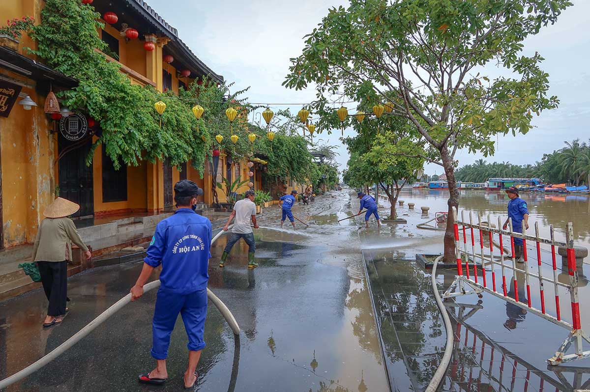
Cleanup tends to happen quickly and without fuss. Roads blocked by mud or landslides are often cleared within a day or two. Homes and shops reopen fast, even if they’ve taken in water. This speed isn’t just practical — it reflects a deeper cultural trait shaped by history. From war recovery to rebuilding after natural disasters, resilience is woven into daily life. Rather than panic, there’s a quiet determination to adapt and move on — something many travelers notice and admire.
Travel tips for dealing with flooding in Vietnam
Floods rarely ruin a trip to Vietnam — but being aware of the risks can help you avoid inconvenience, delays, or soggy shoes. With a bit of planning and flexibility, you can still enjoy the country’s beauty even during the wettest months. Here are some simple tips to keep your travels smooth.
Check the season before you book
Vietnam’s rainy season varies by region. Northern areas are wet from May to September, central Vietnam from September to December, and the south from May to November. If you’re planning to visit multiple regions, check how the seasons line up — you might enjoy dry days in one place and daily showers in another.
For a full month-by-month breakdown, see our guide to the best time to visit Vietnam, which covers both weather and seasonal highlights.
Follow weather alerts during your trip
Weather can change fast, especially during typhoon season. Use reliable apps like Windy, AccuWeather, or the Vietnam Meteorological Service for daily updates. Hotel staff and tour guides are also good sources for local warnings. If a typhoon warning is issued along the coast, it’s wise to adjust your plans — ferries and flights may pause, and riverside areas may flood.
Be flexible with travel plans
Even if your itinerary looks tight on paper, build in buffer time if you’re traveling during the wet season. Rural roads might be muddy, motorbike loops like Ha Giang could face landslide delays, and transport schedules can shift. Most buses, trains, and flights still operate — just don’t cut it too close.
Know which areas flood more
Some places flood so routinely that locals treat it as normal. In Hoi An Old Town, a waterproof bag and a pair of sandals will serve you better than closed shoes. In the Mekong Delta, October’s “floating season” brings high water — but also boat rides through fields, water markets, and beautiful reflections. Don’t avoid it — embrace it.
Stay safe in the mountains
In highland areas like Sapa, Ha Giang, or the Central Highlands, avoid trekking right after several days of rain. Trails can be slippery, and landslides occasionally affect remote roads. If you’re unsure, ask a local guide or your accommodation before heading out.
Book accommodations on higher ground
If you’re visiting during flood season, consider hotels slightly uphill or away from the riverfront — especially in Hue and Hoi An. Riverside stays can be scenic, but during storms, that water might come right into the lobby. Many hotels are prepared, but it’s worth asking in advance.
Travel insurance that covers natural events
Not all policies in travel insurance cover flooding, storms, or weather-related delays. Check the fine print to make sure you’re covered for trip changes or lost bookings caused by natural events. It’s a small step that can save you a lot of stress.